


2. RADAR, CHART RADAR OPERATION
2-36
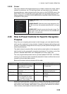
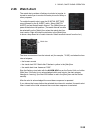
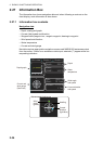
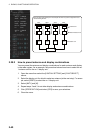
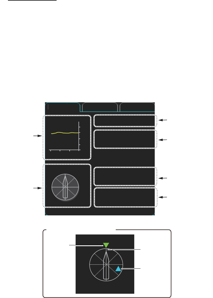
2.27 Information Box
The information box shows navigation data and, when following a route set on the
chart display, route information is also shown.
2.27.1 Information box contents
Navigation data
• Depth, analog and graph
• Current (tide) speed and direction
• Waypoint data (waypoint no., range to waypoint, bearing to waypoint
• Wind speed and direction
• Water temperature
• Current and wind gauge
Nav data requires appropriate navigation sensors and NMEA0183 sentences output
from the sensor. If there is no sentence or data input, asterisks (**) appear at the cor-
responding indication.
Depth graph
Current direction
and speed
Wind angle
and speed
Current and
wind gauge
(See inset.)
Depth :
22.5 m
Water
TEMP :
10.5°C
REL :
006.3°R
Wind : 12.1 m/s
Current :
121.3°R
1.7 kn
NAV data
Route 1 Route 2
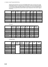
N
E
S
W
0
10
20
30
40
50
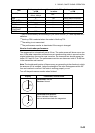
-30 -20 -10 min m
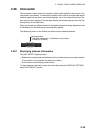
Depth
Water
temperature
Current and wind gauge
Heading
Wind
angle
(green)
N
E
S
W
Current
direction
(light-blue)