


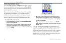
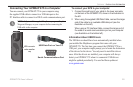
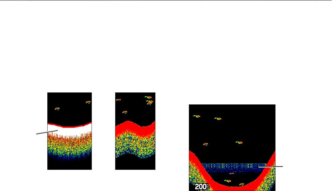
Whiteline
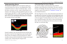
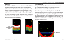
The GSD 20 or GSD 21 can help you determine whether the bottom
is hard or soft. When the sonar sound waves are reected back
by the bottom, a hard bottom returns a stronger signal than a soft
bottom. A thin whiteline indicates a softer bottom, while a thick
whiteline indicates a harder bottom. Normally, a red line is used
to show the point where water meets the bottom. This line follows
the bottom contour, along with any signicant objects lying on the
bottom. The unit uses the whiteline function to make the bottom
layer information easier to distinguish.
Whiteline OffWhiteline On
Thick
Whiteline: Hard
bottom
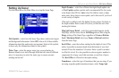
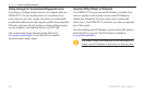
Thermoclines
A rough denition of a thermocline is a break in water where
the water temperature changes faster than the water above it.
Thermoclines are shown as the weakest colors.
One of the unique features offered by Garmin is See-Thru
®
technology, which allows the GPSMAP 278 to hear both weak and
strong signals simultaneously so it can identify sh returns under
the toughest conditions, such as suspended in thermoclines or even
hiding near structures. See-Thru technology allows the GSD 21 or
GSD 20 Sounder Modules to “see” through thermoclines and helps
locate sh where they live.
Thermocline
GPSMAP 278 Owner’s Manual 101
settIng uP And usIng sonAr > understAndIng sonAr