5. To change the location from which you are projecting the new
waypoint, highlight the From eld, and press ENTER.
6. Select the point that you will project your new waypoint from.
For more information see the “Finding an Item” section on
page 17.
7. To adjust the distance that the new waypoint will be projected
beyond the original waypoint, highlight the Distance eld,
and press ENTER. Enter the projection distance, and press
ENTER.
To adjust the bearing that the new waypoint will be projected
from the original waypoint, highlight the Bearing eld, and
press ENTER. Enter the bearing, and press ENTER.
8. When you have adjusted all elements of the projected
location, highlight Save, and press ENTER.
9. Make any other changes to the new waypoint data (such as
the name or symbol); highlight OK, and press ENTER.
Editing a Waypoint
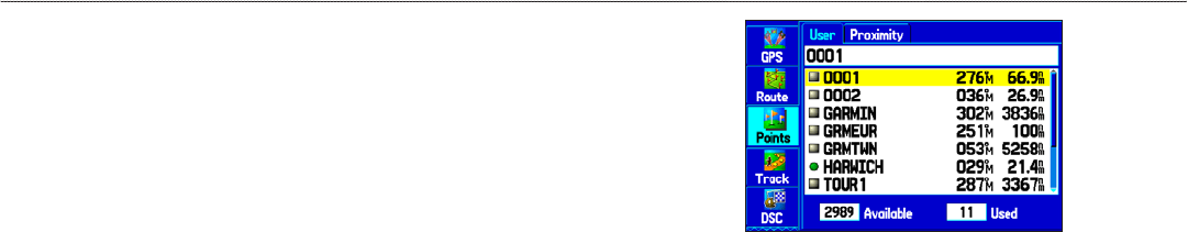
The User sub tab shows a master list of all waypoints stored in
memory. From the User list, you can review, edit, rename, or delete
individual waypoints or delete all user waypoints.
The number of stored and available waypoints is shown at
the bottom of the User sub tab. Stored waypoints arranged in
alphanumeric order.
User Points Tab
To navigate (Go To) a waypoint from the Points tab:
1. Select the Points tab on the Main Menu, and then highlight
the User sub tab.
2. Highlight the waypoint you want in the list.
3. Press NAV to open the Navigate Menu. Highlight Go To
<Point Name>, and press ENTER.
To edit a waypoint:
1. Open the Waypoint Review or Waypoint Edit Page.
2. Highlight the waypoint name, symbol, or eld you want to
change, and press ENTER.
3. Use the ROCKER to select a symbol or enter data, and
Press ENTER when nished.
GPSMAP 278 Owner’s Manual 33
MArIne Mode > creAtIng And usIng WAYPoInts


