


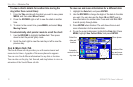
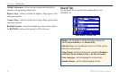
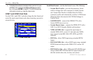
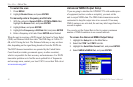

Units Sub Tab
Use the Units sub tab to customize measurement units.
Units Sub Tab
Distance and Speed—select the unit of measure to show your speed
and distance traveled.
Direction Display—select the unit of measure to show your
direction. Mils is a unit of angle measurement used in military
settings, in which 17.78 mils equal one degree.
Temperature—select the unit of measure to show the temperature.
Elevation—select the unit of measure to show your altitude.
Depth—select the unit of measure to show the depth.
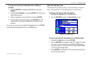
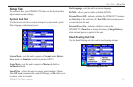
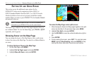
Location Sub Tab
Use the Location sub tab to change location setting information.
See the “Appendix” for more information about location formats
and map datums. Also visit the National Imagery and Mapping
Agency at www.nima.mil for more information on grids and datums.
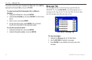
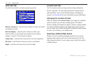
Changing the Location Format
When you change the Location Format, you change the coordinate
system in which a given location reading appears. The default
format is latitude and longitude in degrees, minutes, and thousandths
of a minute (hddd°mm.mmm). Only change the location format if
you are using a map or chart that species a different location format
or want to use a format you are familiar with.
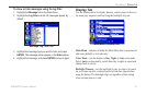
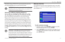
Selecting a Different Map Datum
Datums are used to describe geographic positions for surveying,
mapping, and navigation and are not actual maps built in the unit.
Only change the datum if you are using a map or chart that species
a different datum.
84 GPSMAP 278 Owner’s Manual
MAIn Menu > setuP tAb