


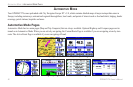
autoMotIve Mode PaGes
Automotive Mode has two main pages (Map and Trip Computer)
that are always available. Optional Highway and Compass pages
can be turned on in Automotive Mode. When you are actively
navigating, the Current Route Page is available if you are navigating
a turn-by-turn route. The Active Route Page is available if you are
navigating off-road. For information about pages and features not
discussed here, see the “Marine Mode Pages” section.
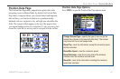
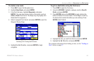
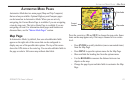
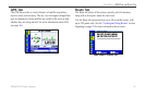
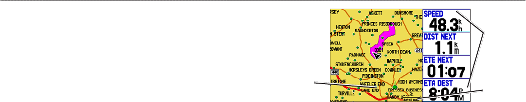
Map Page
In Automotive Mode, by default, four user-selectable data elds
appear on the right side of the screen that can be congured to
display any one of the possible data options. The top of the screen
shows the GPS status or the route leg. You can also add data elds to
the page or select a full-screen map without data elds.
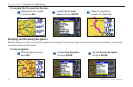
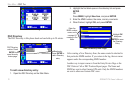
Map Page
Data elds
Map scale
Current
location
Press the zoom keys (IN and OUT) to change the map scale. Some
items on the map appear only if the map is zoomed in to a certain
level.
• Press ENTER
to quickly declutter (remove unwanted items)
from the Map Page.
• Press MENU
to open the options menu for the Map Page.
• Show and hide the heading line from the options menu.
• Use the
ROCKER to measure the distance between two
objects on the map.
• Change the page layout and data elds to customize the Map
Page.
GPSMAP 278 Owner’s Manual 63
AutoMotIve Mode PAges > MAP PAge