


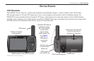
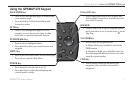
Using The GPSMAP 278
The advanced keypad system on the GPSMAP 278 is designed to
allow you to select options and enter data quickly and conveniently.
As you progress through this owner’s manual, you are directed to
press a specic key or highlight a eld on the screen. When you
are directed to press a key, you should press and quickly release the
key. If the key needs to be held down for a period of time to start a
secondary function, the instructions tell you to do so. When a eld is
selected on the screen, it is highlighted in yellow.
The following terms are used throughout this manual:
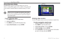
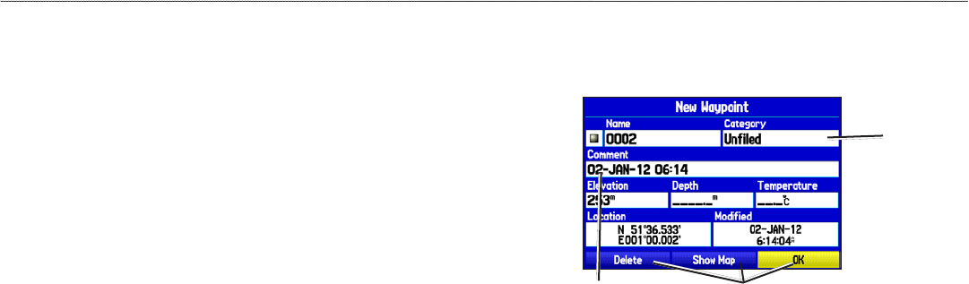
• Highlight
—move the highlighted area on the screen up,
down, left, or right with the ROCKER to select individual
elds. Moving the highlight to a given location allows you to
make a selection, begin data entry, or scroll through a list.
•
Field—the location on a page where data or an option can
be shown and entered. Select (highlight) a eld using the
ROCKER to begin entering data or selecting options.
•
On-screen button—use the ROCKER to highlight a button,
and press ENTER to select the button.
•
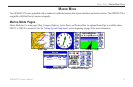
Scroll bar—when viewing a list of items too long to show on
the screen, a scroll bar appears along the right side of the list.
To scroll through a list, press up or down on the ROCKER.
•
Default—the factory setting saved in the unit’s memory. You
can change the settings, and you can also revert to the factory
(default) settings when you select Restore Defaults.
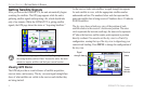
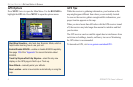
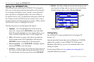
Highlighted eld
Field
On-screen buttons
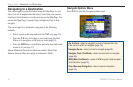
Cartography
The GPSMAP 278 comes preloaded with City Navigator NT
Europe v 9.0
Optional preloaded Garmin data cards and MapSource CD-ROMs
enhance the versatility of your GPSMAP 278. With optional
MapSource BlueChart g2, you can view information that is not
already pre-loaded.
See the Garmin Web site at www.garmin.com/cartography/ for
compatible MapSource products.
8 GPSMAP 278 Owner’s Manual
gettIng stArted > usIng the gPsMAP 278