


GettInG started
Unit Overview
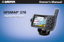
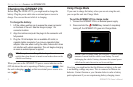
The GPSMAP 278 is an all-in-one, versatile color chartplotter and automobile navigator—perfect for land or water. This portable
GPS navigator features a 256-color TFT display that is easy to read in bright sun and includes a built-in worldwide basemap. The
GPSMAP 278 comes preloaded with City Navigator
®
NT Europe, which contains street maps and a points of interest (POIs) database,
including motels, restaurants, fuel, ATMs and more. In addition, GPSMAP 278 accepts customized points of interest such as school zones
and safety cameras and includes proximity alerts to warn you of upcoming POIs.
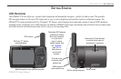
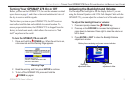
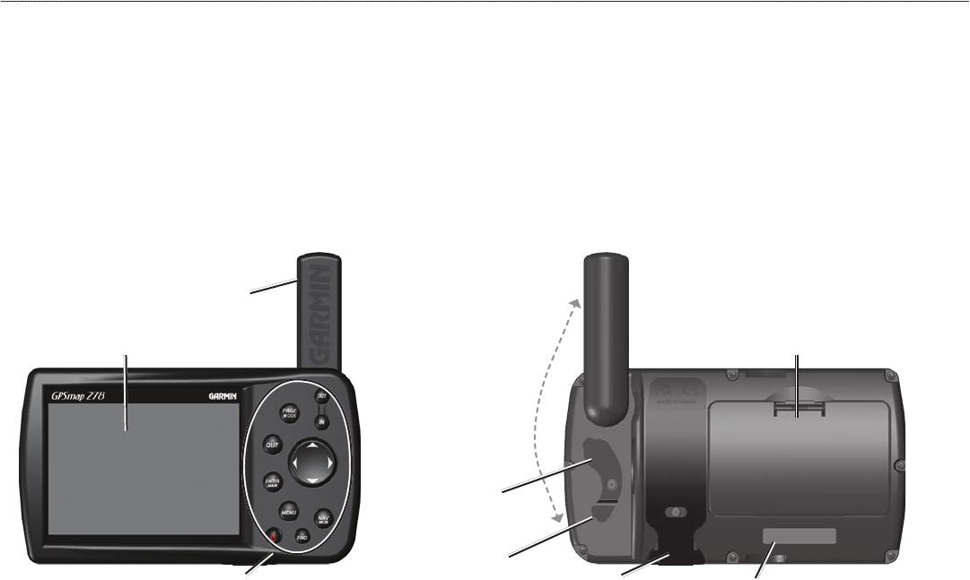
External power
connector under
weather cap
USB connector
under weather cap
Slot for optional data card
Battery pack. Press tab down
to remove battery pack for
replacement, if necessary.
Backlit keypad for easy nighttime operation
GPS antenna
256-Color TFT display
with backlighting
Detachable GPS antenna
collapses for storage.
Be sure the antenna
is up (as shown
here) to receive
satellite signals. See
the “Appendix”,
page 108, for
instructions on
removing the
antenna.
Serial number
GPSMAP 278 Owner’s Manual 1
gettIng stArted > unIt overvIeW