


59
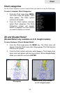
Chart
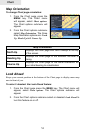
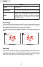
• Texture Type — Enables (on) or disables (off) the 3D shading feature.
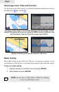
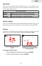
Photo overlay allows you to enable (full) or disable (off) the aerial photog-
raphy overlay chart feature.
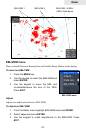
• Annotation — Allows you to display "Main" names (i.e. city names) only
or the "Full" set of names on the Chart page.
• Presentation Types — Is used for the selection of the symbols and colors
of the navigation chart "look and feel"; either U.S. or International "paper
chart" presentation types can be selected.
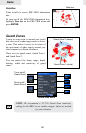
• Chart Details — This menu is used to select which object types and infor-
mation layers are displayed on-screen.
Available options:
Standard: Equivalent to standard display settings as defined in ECS
(Electronic Charting System) regulations.
All: Enables the display of all the object types and information layers on
the Chart page.
User: Allows selection of individual object types and information layers
on-screen.
NOTE: These features are only applicable with Navionics
Platinum™ or Platinum Plus™ charts.