


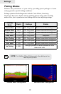

77
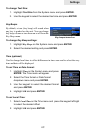
Settings
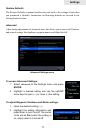
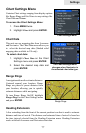
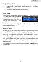
Chart Settings Menu
Contains Chart settings ranging from display options
like Range Rings and Grid Lines to map settings like
Chart Data and Datum.
To access the Chart Settings Menu:
1. Press MENU twice.
2. Highlight Chart and press ENTER.
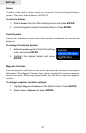
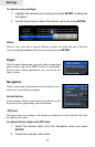
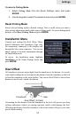
Chart Data
This unit can use mapping data from Lowrance
and Navionics. The Chart Data menu allows you
to select the desired map data (Shaded relief
mapping data available in US only).
To select chart data:
1. Highlight Chart Data on the Chart
Settings menu and press ENTER.
2. Select the desired map data and
press ENTER.
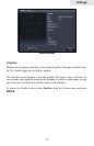
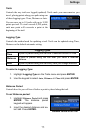
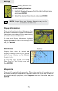
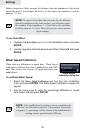
Range Rings
A navigation aid used to estimate distances.
Centered around your location, Range
Rings are placed a preset distance from
your location, allowing you to quickly
estimate distances while navigating.
To turn Range Rings On/Off, highlight
Range Rings on the Chart Settings menu
and press ENTER.
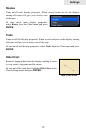
Heading Extension
A line extending from the front of the current position icon that is used to estimate
distance and time of arrival. The distance and estimated time of arrival is based on
the time interval selected from the Heading Extension menu. Heading Extension
works with both Lowrance and Navionics chart data.
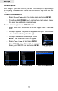
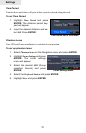
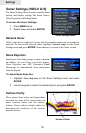
Chart Settings Menu
Range Rings
The Chart Settings menu
changes when Navionics is
the selected chart data type.