


RayTech Navigator User’s Guide
1-2
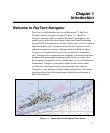
Easy Marine Navigation Using Routes and Waypoints
RayTech Navigator takes the guesswork out of marine navigation by
enabling you to easily chart, plot, and execute simple or complex
routes. A route is composed of a series of waypoints that you select
on the screen, with each waypoint denoting a certain position along
the path of the route. A route typically has a starting waypoint and an
ending waypoint, and as many intermediate waypoints as you need or
want. Using Navigator, you can create a route to any destination with
a few simple clicks of the mouse, and then follow it manually or
enable your vessel’s autopilot to follow the route/waypoints you have
designated. Routes and waypoints can easily be changed “on the fly,”
should weather or other factors necessitate a change in course.
Multiple Chart Formats for Flexibility
Navigator uses the latest digitized versions of the paper charts
traditionally used in marine navigation, and supports a variety of
popular chart formats:
• C-Map
®
NT
• Maptech
®
NOAA/BSB
• Maptech PCX
• Maptech Photo Regions and Topographical Charts
• SoftCharts
®
Nautical Charts and PhotoNavigator
These charts fall into three basic types:
• Vector – A paper chart that has been digitized
into a format consisting of line segments.
Vector charts can be easier to read than
a rasterized chart, but may not include
the level of detail found in Raster charts.
The C-MAP chart is an example of a
vector chart.