


RayTech Navigator User’s Guide
4-6
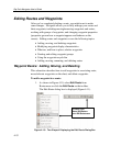
Working With Routes
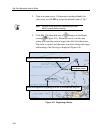
This section explains how to plot and edit routes. A route is a path
from location A to location B, and is composed of a series of
waypoints that you “place” on a displayed chart. Each waypoint
represents a certain position along the path of the route. A route
typically has a starting waypoint, an ending waypoint, and as many
intermediate waypoints as you need or want.
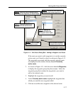
The distance between any two waypoints is known as a leg. The leg
of the route your boat is currently traversing is called the active leg.
An active leg consists of an origin waypoint (the waypoint you just
departed) and a destination waypoint (the waypoint you are moving
toward). In Navigator, the active leg of a route is represented by a
dashed line and a blinking gray circle around the destination waypoint.
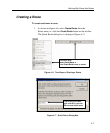
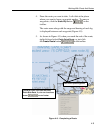
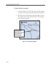
Plotting a route requires just a few mouse clicks, and you can easily
move/adjust your waypoints after placing them on the screen. Routes
can be as simple or complex as you need, and by offering a wide range
of icons and display colors, Navigator allows you to customize each
route (and individual waypoints) for easy recognition and navigation.
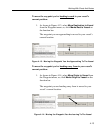
Navigator stores all your favorite or most commonly used routes, and
you can create several backup routes for any destination, should
inclement weather or other circumstances dictate you take a different
course. If you have Navigator connected to a GPS and Autopilot, the
route you chart on the screen can be run automatically.
Note: The subsections that follow presume that you already
have charts installed and displayed within Navigator.