


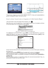

Page 42 GPS Chart Plotters
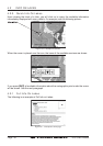
· Dynamic Elevation Data (optimized palettes for GPS Chart Plotters; includes new
NOAA palette)
· Perspective View ("Real World" perspective view of the chart, updated real-time during
navigation)
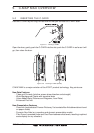
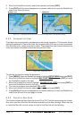
MAX and NT/NT
+
C-CARD coexistence
· When NT
+
data and MAX data cover different areas, the GPS Chart Plotter receives
data from both charts (depending on the current position).
· When NT
+
data and MAX data cover the same area, the GPS Chart Plotter receives
data only from MAX chart.