


GPS Chart Plotters Page 53
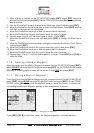
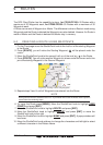
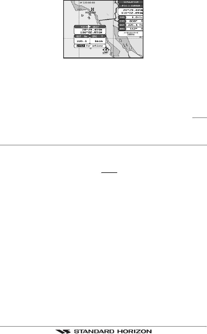
Figure 7.4a - Navigating to Cursor Example
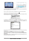
5. Now the GPS Chart Plotter shows a bearing line between the vessels location and the
destination point. A popup window shows the Distance (DST) and Bearing (BRG) from
the vessels location to the destination point.
6. The GPS Chart Plotter is in Cursor mode, to switch to Home mode press [CLR] so the
vessel will stay in the center of the page.
7. On the CP300/CP300i two Soft Keys are also shown that allow you to quickly switch to
the HIGHWAY page or to stop navigation.
8. To STOP Navigation, press [GOTO] and the WARNING page is shown. Select
STOP
and press [ENT].
7.5 GOTO MARK
1. Move the ShuttlePoint knob to an open position (no buoy, warning etc. under the cursor)
on the Chart page.
2. Press [GOTO] to show the GOTO popup window.
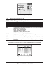
3. Move the ShuttlePoint knob to highlight
MARK and press [ENT] to show the MARKS/
WAYPOINTS List.
4. Move the ShuttlePoint to the highlight the desired Mark or Waypoint and press [GOTO].
5. You will notice a circle is drawn around the Icon Symbol. This means the GPS Chart
Plotter is now navigating to the point.
6. Press [CLR] to switch to the Chart page or Highway page to start navigating to the point.