


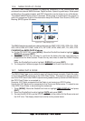


GPS Chart Plotters Page 79
13. ADVANCED SETTINGS
The Advanced Setup menu allows customization of many GPS functions, Alarms and
NMEA interfacing.
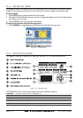
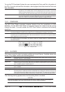
1. Press [MENU]. Move the ShuttlePoint knob to highlight
SETUP MENU and press [ENT].
2. Move the ShuttlePoint knob to highlight
ADVANCED SETUP and press [ENT] or move
the ShuttlePoint knob to the right.
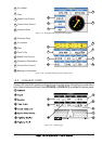
While in this menu you will see many selections which are described in the next sections.
13.0 INPUT/OUTPUT (NMEA)
The CP180 has 2 NMEA inputs and 3 NMEA outputs, while the CP180i has 1 NMEA inputs
and 2 NMEA outputs. The CP300 has 4 NMEA inputs and 5 NMEA outputs, while the CP300i
has 3 NMEA inputs and 4 NMEA outputs. The NMEA outputs can be configured to send
specific NMEA messages.
NOTE
After a software upgrade the RAM is cleared and then the GPS Chart Plotter starts with the
default settings.
After reset is performed the Input/Out Connections menu must be configured to allow AIS and
FF520 operation.
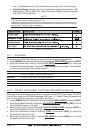
13.1 NAVIGATE
The Navigate Menu allows customization of the Coordinate System (Loran TD's), Map
Datum, Map Orientation Resolution (angle the vessel has to change before the chart is
redrawn) and Static Navigation. See the following table
Coordinate System : Selections are:
a. TD: Loran TD
b. UTM: Universal Transverse Mercator Grid
c. ddd mm.mmm:Degrees Minutes and Thousands of Minutes
d. ddd mm.mm: Degrees Minutes and Hundredths of Minutes
e. ddd mm.ss: Degrees Minutes and Seconds (default)
Map Datum : Allows selection of Map Datums. The default Datum is WGS84 as C-MAP cartography
has been compiled using the WGS84 Datum.
Map Orientation Resolution: Sets the angle the vessel has to change before the chart is redrawn. The default setting
is 30 degrees. Example: if the vessel is heading 000T at a speed of 25 Knots, the display
will redraw:
a. In Home mode the GPS Chart Plotter centers the location of the vessel in the center
of the display. To keep the vessel in the center of the display the GPS Chart Plotter
will occasionally redraw.
b. If the vessel changes course greater than 330T or more than 30T the chart will be
redrawn.
Static Navigation : Sets up a threshold for the speed. When the speed received from the positioning device
is under that threshold, the GPS Chart Plotter displays zero. The default setting is 0.9 Kts.
The Loran TD selection allows the GPS Chart Plotter to be set up so the user can enter in
LORAN TD’s directly into the GPS Chart Plotter. After the TD’s have been entered, and the
user changes to ddd mm.sss (Degrees Minutes and Seconds) the TD’s will be converted
to Lat / Lon coordinates.