


Page 74 GPS Chart Plotters
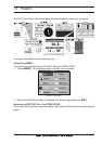
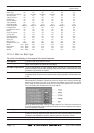
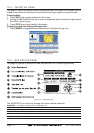
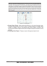
12.4 CELESTIAL PAGE
This page is useful for boaters that are concerned about the height of the water under a
bridge or by fisherman that wish to know the tide and moon phase of a specific date.
Changing date
1. Press [ENT] and a popup window will be shown.
2. Moving the ShuttlePoint knob up or down changes the digits and left and right selects
the month, day and year.
3. Press [CLR] to exit and view the information.
Changing to and from Daylight Savings time
1. Press [MARK] to toggle between Standard and Daylight Savings time.
Figure 12.4 - Celestial page
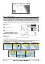
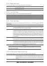
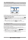
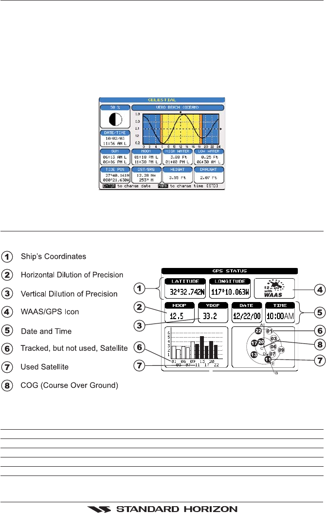
12.5 GPS STATUS PAGE
This page is used as a reference to see how well the GPS is receiving satellites.
Figure 12.5 - GPS Status page
The WAAS/GPS Icon area may change due to the satellite reception:
ACQUIRING : the GPS is trying to receive a valid position fix.
GPS2D : The GPS is receiving at least 2 valid Satellites
GPS3D : the GPS is receiving at least 3 Satellites.
WAAS 2D/3D : the GPS is receiving a 2D or 3D position and the correction from the WAAS Satellite.
HDOP : Horizontal Dilution of Precision
VDOP : Vertical Dilution of Precision