


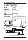
Page 88 GPS Chart Plotters
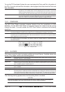
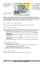
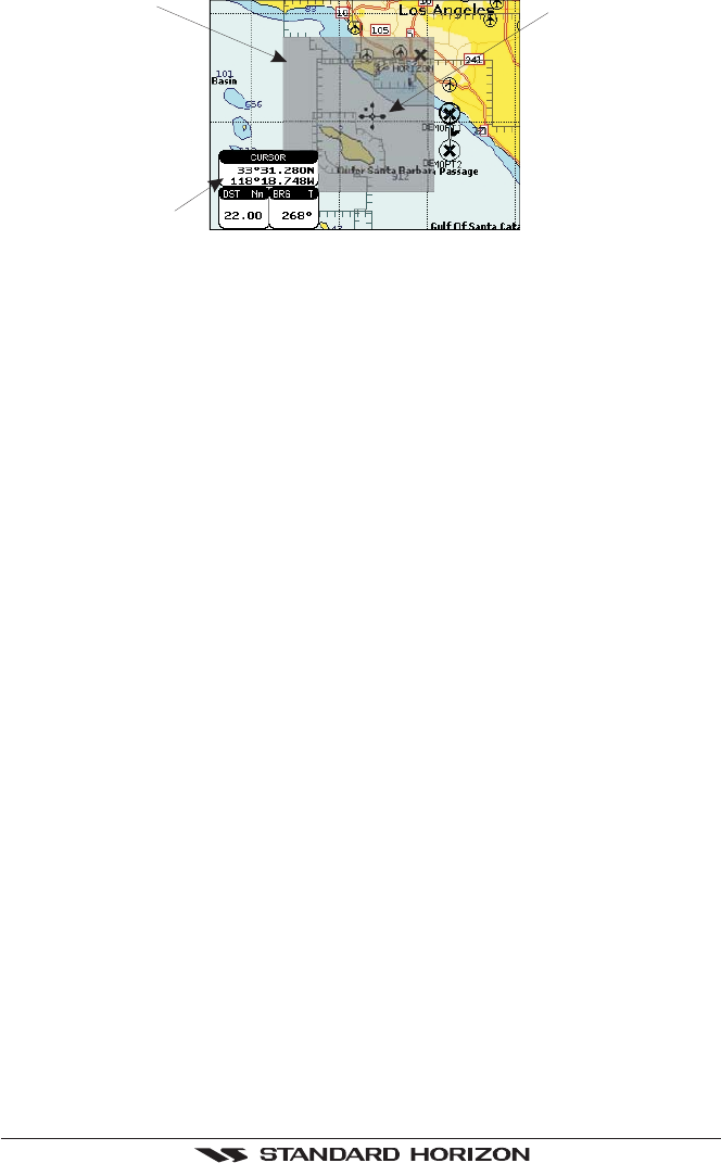
Area of coverage of
downloaded data is
located by default with
its centre on the
cursor position
Indicates the LAT/LON
position of the cursor
Cursor is locked to the
gray area.
Moving the cursor also
moves the gray area
allowing locating it
over the area where
the user wants to
download the Meteo
forecast.
Figure 15.0.0 - Example of Download Area on CP180/CP180i
Press [LOAD] (or [ENT] for CP80/180i) to activate the C-MAP Weather Download: the
whole data package (see the previous "Weather data package" table) are downloaded.
[S
TOP] (or [CLR] for CP180/CP180i) allows to interrupt the data download. At the end of the
operation press [E
XIT] (or [CLR] for CP180/CP180i) to close the window.
15.0.1 Copy From User C-CARD
Allows the whole data package C-Weather loading from the User C-CARD.
15.0.2 Weather Forecast
Allows selecting the Layer of specific weather data to be displayed on the screen and to
change date and time of the forecast preview. The following functions are available:
♦ Panning: default usage of the cursor key is the normal panning function.
♦ Zoom in/out: zoom in/out functions are allowed as usual by using [ZOOM IN]/
[ZOOM OUT].
♦ Set of date and time: [DATE ] (or [ENT] for CP180/CP180i) to modify date and
time values.
♦ Layer selection: [LAYER] (or [MENU] for CP180/CP180i) to cycle of the
weather layers.
♦ Exit: [EXIT] (or [CLR] for CP180/CP180i) to close the weather prediction page.
15.0.3 Real Time View
The following selections are available:
♦ Real Time View On: the data is shown (the area of the download) at the cur-
rent date and time (received from the GPS).
♦ Real Time View Off: the Weather data is not displayed.
The layer displayed is the one selected into the previous menu item.
15.0.4 Type of Data
Allows selecting the type of data, refer to the table in the Figure 15.