


turtles,
submerged floats,
air
bubbles,
etc.
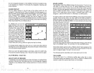
Individual tree limbs
extending
outwards from a
group
of
limbs isthe
hardest
objectforthe
Fish l.D.
feature
to
distinguishfromfish.
You
maysee
Fish l.D.
symbols
on the
screenwhen
actually,
there
are no
fish. Practice
with the unit in
the Fish
ID. mode to
become more
familiar
with the
Fish I.D. feature.
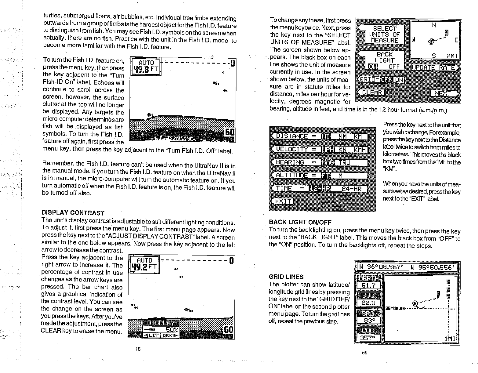
ToturntheFishj.D.featureon
I AUTO I
———-0
pressthemenukey,thenpress
]Lh198
FTD
the
key adjacent
to the
'Turn
Fish-ID On" label.
Echoes will
continue
to scroll
across
the
screen,
however,
the surface
clutter
at the
top
will no
longer
be
displayed.
Any targets
the ________________
micro-computerdetermines are
fish will be
.displayed
as fish
symbols
To
turn the Fish
l.D.
feature off
again,
first
press
the
menu
key,
then
press
the
key adjacent
to the
"Turn Fish I.D. Off"
label.
Remember,
the
Fish I.D.
feature can't be
used when the
UltraNav II is
in
the
manual
mode. If
you
turn
the Fish I.D.
feature on when
the UltraNav II
is
in
manual,
the
micro-computer
will
turn the automatic
feature on. If
you
turn automatic
off when the
Fish I.D.
feature is
on,
the
Fish l.D.
feature will
be turned off
also.
DISPLAY
CONTRAST
The
unit's
display
contrast is
adjustable
to
suit different
lighting
conditions.
To
adjust
it,
first
press
the
menu
key.
The
first menu
page appears.
Now
press
the
key
next to the
"ADJUST DISPLAY
CONTRAST"
label. A screen
similar to the one
below
appears. Now
press
the
key adjacent
to the left
arrowto
decrease the
contrast.
Press the
key adjacent
to the
FUTO
a
right
arrow to
increase it.
The
FT
percentage
of contrast in
use
changes
as
the arrow
keys
are
pressed.
The bar
chart also
gives
a
graphical
indication of
the
contrast level. You can
see
the
change
on the
screen as
you pressthe
keys.
Afteryou've
madethe
adjustment,
pressthe
Go CLEAR
key
to erase
the menu.
I
DRK
18
To
change
anythese,
first
press
the menu
keytwice.
Next,
press
the
key
next to the "SELECT
UNITS
OF MEASURE'
label.
The
screen shown below
ap-
pears.
The black
box on each
line
shows the unit of
measure
currently
in use. In
the screen
shown
below,
the units of mea-
sure are in
statute miles for
distance,
miles
per
hourforve-
locity, degrees
magnetic
for
bearing,
altitude in
feet,
and time is iii the
12 hour
format
(a.m.Ip.m.)
IE-
ELOCITY jj
<N
KMH
IN6=-
UOE=M'
BACK LIGHT
ONIOFF
Press the
key
next to the unit
that
youwishtochange.
Forexample,
pressthekeynexttothe
Distance
label twice to switch
from miles to
kilometers. This
movesthe black
box two times from the
"MI" to the
'XM".
When
you
have
the units of mea-
sure
setas
desired,
pressthe key
next to the
"EXIT' label.
To turn
the back
lighting
on,
press
the
menu
key
twice,
then
press
the
key
next to
the "BACK LIGHT' label. This
moves the black
box from "OFF" to
the
"ON"
position.
To turn the
backlights off, repeat
the
steps.
GRID LINES
The
plotter
can show
latitude!
longitude grid
lines
by pressing
the
key
nextto the "GRID
OFF!
ON" label on the second
plotter
menu
page. Toturnthegrid
lines
off,
repeat
the
previous
step.
H
36°O 836?' bJ
96°EO.S%'
fl
rr
—
IA
22.0
aE÷na.as——
830
i..........,.
60
TIME
=
24—HR
59
PDF compression, OCR, web-optimization with CVISION's PdfCompressor