


2-1
2. NAVIGATION DATA DISPLAY
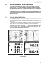
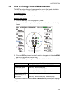
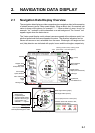
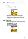
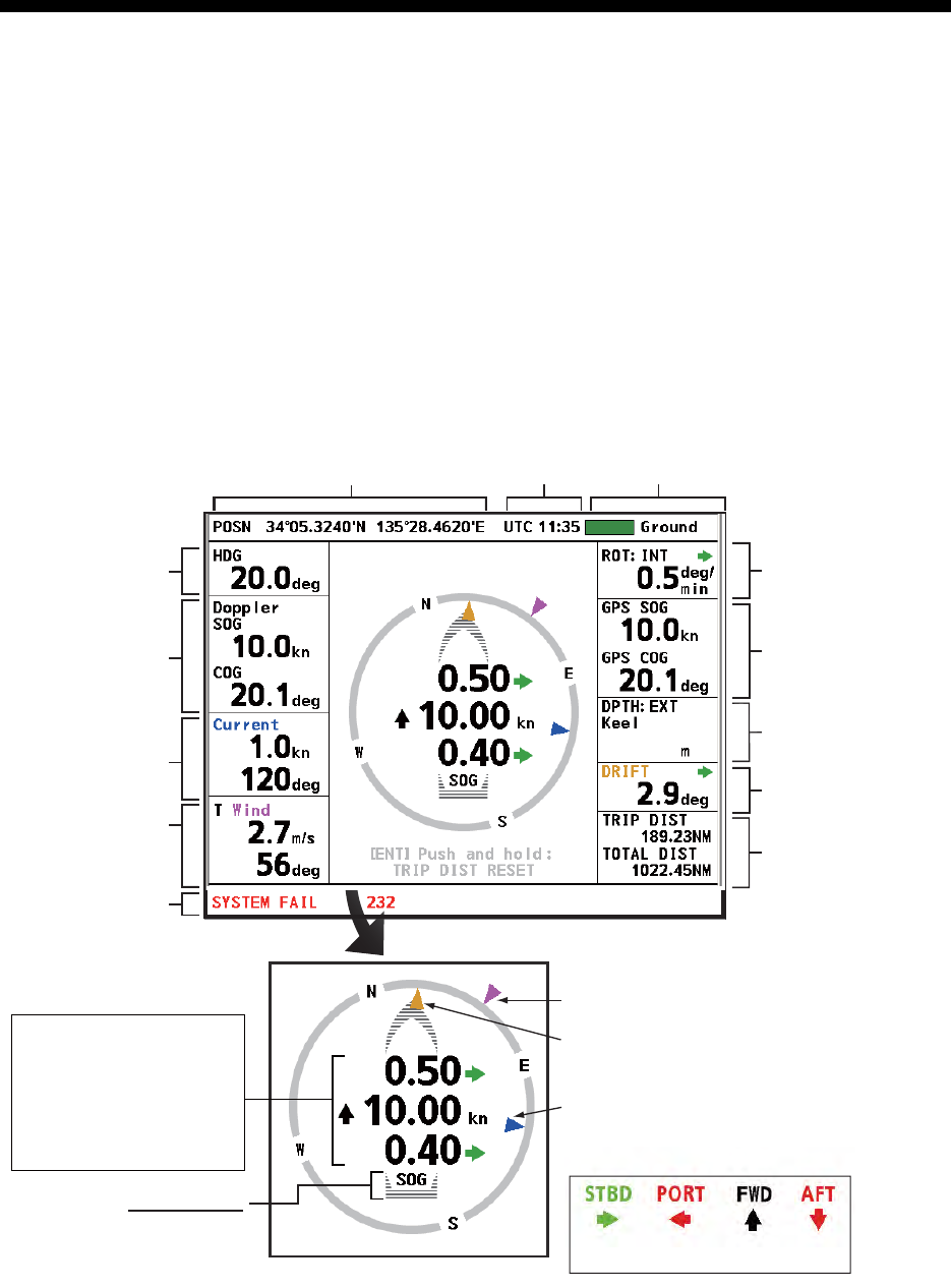
2.1 Navigation Data Display Overview
The navigation data display provides comprehensive navigation data (with connection
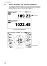
of related sensors) and a 3-axis speed display. When a data is lost, its numerical indi-
cation is shown with hyphens; for example, “---.-”. When a data is in error, its unit; for
example, “kn,” is shown in white characters on a red background. The “normal” unit
appears again when the data returns.
The 3-axis speed display mainly shows transverse speed at the reference point, lon-
gitudinal speed and transverse speed at the stern. The direction indicators can be
shown with arrows or text, selectable from the menu. Wind angle, drift angle and cur-
rent (tide) direction are indicated with purple, brown and blue triangles, respectively.
Trip distance,
Total distance run
Drift angle
Depth source,
depth (from transducer)
GPS-measured
SOG, COG
Heading
Doppler sonar
measured
SOG(STW), COG
Position
ROT source,
ROT
Current (tide)
speed, direction
Wind reference,
speed,
angle
1)
2)
*
*
3)
*
Wind angle marker (purple)
Drift angle marker (brown)
* Direction shown with arrows or text,
selectable from the menu.
(green) (red) (black) (red)
Tracking mode
SOG: Speed over the ground
STW: Speed through the water
1) Transverse speed at
reference point
2) Longitudinal speed
3) Transverse speed at stern
(Requires rate-of-turn gyro
or gyrocompass. If no
connection, “--.--” appears.
3-axis speed display
Message area
Current (tide) direction marker (blue)
*
Time
Tracking mode monitor, tracking mode
(See section 1.5 for description.)
56.0
56.0