


12. ROUTES
12-2
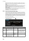
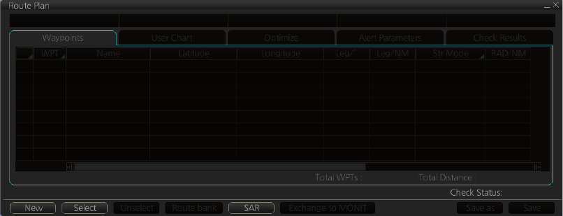
12.2 Main Menu for Route Planning
The main parameters for the route planning are:
• Latitude and longitude of the waypoint
• Channel limits to the waypoint
• Turning radius of the waypoint
• Maximum speed limit and planned speed for each leg
There are two phases for a route: Route Plan and Route Monitor. Route plan is used
for planning the route and route monitor is used to control a route for monitoring.
To complete route planning, do the following.
1. Create a new route or choose an existing one. See section 12.3.
2. Modify your route if necessary. See section 12.5.
3. Make chart alert (safe water) calculation. See section 12.3.5.
4. Optimize your route. See section 12.8.
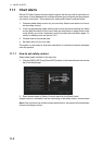
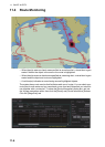
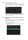
12.3 How to Create a New Route
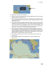
To make a complete route for a voyage, do the following:
1. Click the [PLAN] button on the Status bar to activate the Voyage planning mode.
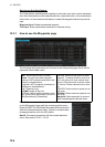
2. On the InstantAccess bar, click the [Planning] button followed by the [Route] but-
ton to open the [Route Plan] dialog box.
3. Click the [New] button.
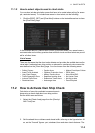
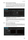
4. Use the cursor to select a position for the first waypoint then push the left mouse
button. A waypoint mark appears on the position selected, and the latitude and
longitude of the position are entered into the [Route Plan] dialog box. After enter-
ing a waypoint, edit Name, Steering mode, Radius, Channel limit, Plan SPD, SPD
Max and Margin as appropriate in the [Route Plan] dialog box, using the keyboard
on the Control Unit or the software keyboard. (For other than steering mode, put
the cursor on an item to show up and down arrows. Put the cursor on an arrow
and click to change setting.)
Note: A guide box that shows the range and bearing between waypoints as you
drag the cursor is available. You can show or hide the box with the [Guide Box]
button on the InstantAccess bar. Click the button to show its background color in
light-blue to display the guide box.