


10. How to Plan Routes
10-5
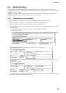
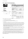
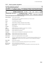
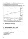
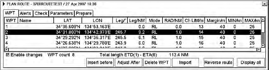
10.3.1 How to process waypoints
Following fields and buttons can be found in the WPT page.
Enable changes:
Check to edit waypoints.
Note: Routes can only be modified in the North-up or Course-up mode.
WPT:
Each waypoint has a number.
Name:
You can name each waypoint.
LAT:
WPTs latitude co-ordinate is displayed in chosen datum.
LON:
WPTs longitude co-ordinate is displayed in chosen datum.
Leg/°
Bearing of leg
Leg/NM:
Leg's length (nm)
Mode:
Define steering mode, rhumb line or great circle, for each leg.
RAD/NM:
Define turning radius for each waypoint.
Ch LIM/m :
Define channel limit for each leg.
Margin/m
Define extension for channel to be checked against selected alerts.
(Spd) MIN/kn:
Define minimum speed of ship used with a leg.
(Spd) MAX/kn:
Define maximum speed of ship used with a leg.
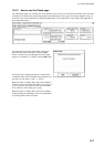
Insert before:
Insert a new waypoint before the current waypoint.
Insert after:
Add a new waypoint after current waypoint. You can define direction and distance for next
waypoint. (If the waypoint is not the last waypoint in a route, the button name changes to
Adjust after).
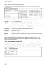
Delete WPT:
Delete current waypoint.
Import:
Import new waypoints from already existing routes into your current route.
Reverse route:
Reverse sailing order of the entire route.
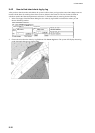
Display all:
Center line, channel borders, WPT marks and leg marks are made visible on top of the
electronic chart.