


12
1
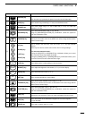
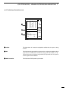
r PLOTTER MODEq AVAILABLE SCREENS AND INDICATIONS
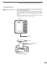
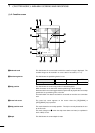
(1)-1 How to access screens
In plotter mode, the following two screens are available.
Pressing the [PLOTTER] key in plotter mode allows selection between the coast-
line screen and the navigation monitor screen.
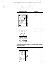
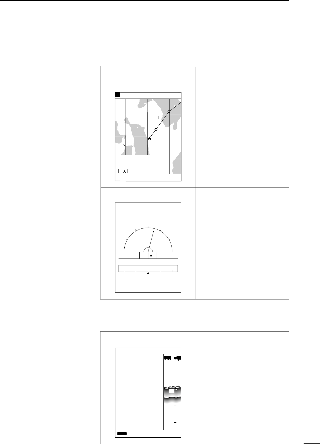
This screen indicates various naviga-
tional data including coastlines, track
and marks.
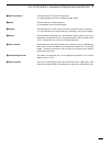
This screen indicates easy-to-under-
stand graphical and text information
helpful for navigation.
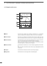
This screen shows GPS/DGPS infor-
mation.
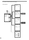
Screen No. and name Description
Coastline screen
Navigation monitor screen
Positioning Information screen
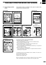
80.0 FT0°T 12KT 54.3°F
RANGE 32
8
TO WP 1
23.00
NM
30°
34°21.362N 28°
135°06.950E 18.05
NM
1:32
80.0 FT0°T 12KT 54.3°F
LON
LAT
345°
14:25
01:05
15:30
TIME
TTG
ETA
15:30TTFD
W P
No. 1
D/D
C/D
D/FD
10.45NM
10.45NM
DEVIATION
0.03
NM
134°01.000E
34°18.000N
0
10
20
30
40
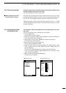
POSITIONING INFO
SAT# S/N BRG ELV
DOP
DGPS INFOMATION
RD-200
Rev.1.1
FREQUENCY 283.5
kHz
BAUD RATE 200
S/N 00
1.50
BACK
12 50 0 81
15 45 90 79
02 40 180 56
16 52 270 63
20 60 45 30
22 30 135 10
10 56 225 25
09 63 315 44
CLR
80.0FT
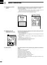
The Positioning Information screen can be accessed from the Positioning
Menu screen. (☞ P. 38)