


15
1
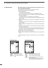
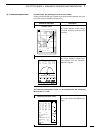
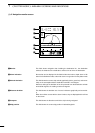
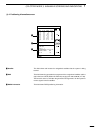
r PLOTTER MODEq AVAILABLE SCREENS AND INDICATIONS
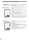
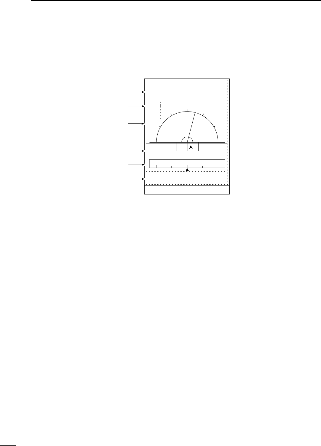
(1)-3 Navigation monitor screen
z Monitor
x Alarm indication
c Azimuth deviation
v Distance deviation
b Compass
n Ship position
This field shows navigation data including the destination No., the destination
azimuth, the distance to the destination, and the time to arrive the destination.
Alarms that can be displayed in this field include shoal alarm, depth alarm or fish
alarm for the fishfinder mode, and arrival alarm or range alarm for the plotter mode.
This field shows the current ship azimuth graphically (with a green line) and numer-
ically on the assumption that the destination azimuth is zero degree.
Note that, although the deviation of the ship azimuth from the destination azimuth
exceeds 90 degrees, the reading remains 90 degrees.
This field shows the deviation out of course in distance graphically and numerical-
ly.
When alarm limits are set with the alarm function, they are displayed with red lines
on the screen.
This field shows the direction to which the ship is being navigated.
This field shows the current ship position in latitude/longitude.
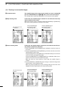
0°T 12KT 54.3°F
ARRV
ALRM
FISH
ALRM
80.0 FT
345°
14:25
01:05
15:30
TIME
TTG
ETA
15:30TTFD
No. 1
10.45NM
10.45NM
W P
D/D
C/D
D/FD
LON
LAT
DEVIATION
0.03
NM
134°01.000E
34°18.000N
z
x
c
v
n
b