


45
1
rSOUNDER MODEq AVAILABLE SCREENS AND INDICATIONS
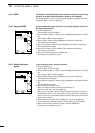
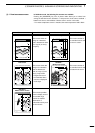
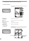
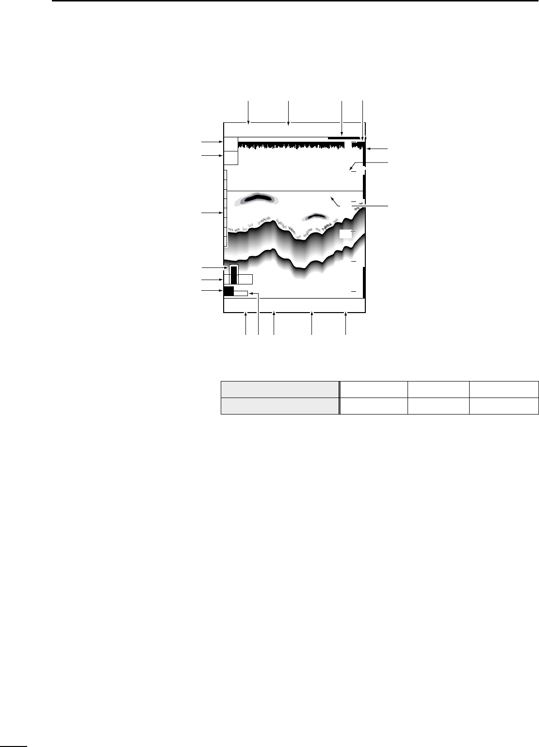
(1)-1 Standard screen
This field shows the positioning device in use.
This field shows the current ship position in latitude/longitude or time difference.
In this field, a moving 30-second time mark is always indicated in yellow.
The current ship position is located at the upper right corner in fishfinder mode.
Alarm range markers are monitor range indicators. The shoal alarm range is indi-
cated in red, the depth alarm range in yellow, and the fish alarm range in green.
This screen has FT scales in 20 FT (default; m) increments (☞ P. 52).
The depth marker (green) and depth value are indicated during depth measure-
ment.
This field shows the current depth of water. If the level of reflections from the bot-
tom is low, this may not be displayed.
This field shows the current water temperature ranging from 0.0 to +40.0 in °C or
+32.0 to +104 in °F. If the water temperature is out of this range, “
**
.
*
” is displayed.
If no water temperature sensor is installed, the field is blank.
GPS 48°21.417N 125°26.643W
31.5
RANGE
z
x
c
v
b
n
m
,
.
⁄0⁄1
⁄2
⁄3
⁄4
⁄5
⁄6
⁄7
⁄8
DPTH
ALRM
ZONE
ALRM
H
AUTO
FT
43.4
315
°T
10
.
2KT 58°F
20
40
60
80
0
100
z Positioning device
x Ship position
c Time mark
v Ship position
b Alarm range marker
n Depth scale
m Depth marker
, Depth
. Water temperature
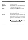
Indication
Positioning device in use
EXT
External NMEA
DGPS
DGPS+GPS
GPS
GPS