


57
16
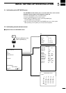
rSOUNDER MODEq HOW TO READ IMAGES
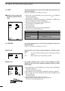
(16)-1 Reflections from the
sea bottom
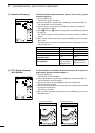
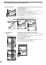
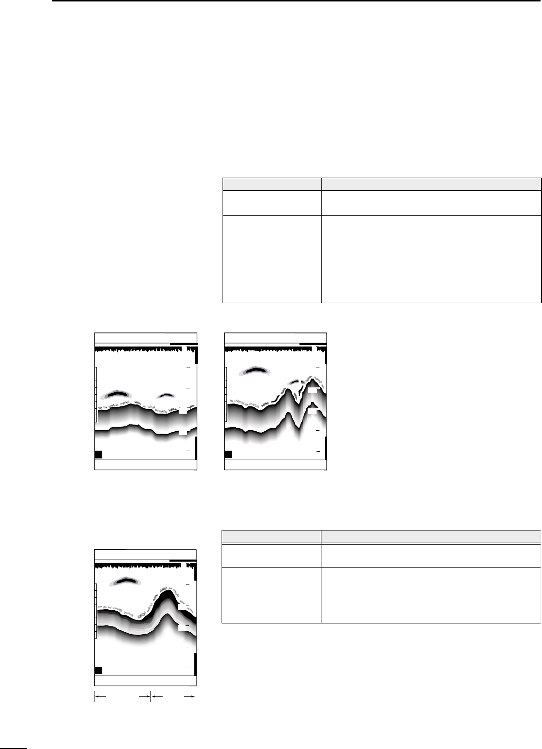
Å Reading topographical features
of the sea bottom
Reflections from the sea bottom are displayed in red provided that the sen-
sitivity is properly set (☞ P. 52).
Screen images of the sea bottom provide you with information on the topographi-
cal and geological features of the sea bottom. Such information will help you
search for good fishing banks.
Submarine terrains may be flat or hilly, just as is the case with land.
On screen images, topographical features of the sea bottom are displayed,
as in:
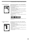
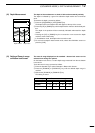
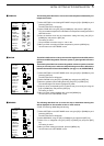
On screen images, geological features of the sea bottom are displayed, as in:
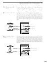
Soil/sand Rock
H
315°T 10.2KT 58°F
FT
51.4
GPS 48°21.417N 125°26.643W
20
40
60
80
0
100
ı Reading geological features of
the sea bottom
H
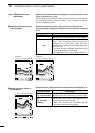
Flat terrain Hilly terrain
H
315°T 10.2KT 58°F
FT
58.4
GPS 48°21.417N 125°26.643W
20
40
60
80
0
100
20
40
60
80
0
100
315°T 10.2KT 58°F
FT
43.4
GPS 48°21.417N 125°26.643W
Topographical feature
Flat
Hilly
Screen image
Assuming that its geological features are constant, the
displayed contour of a flat terrain has a uniform width.
The displayed contour of a hilly terrain has a long
tailing*
1
. This is because the ultrasonic sent from the
transducer has a certain beam angle and hence
reflections from a bank vary in time of their returning to
the transducer*
2
.
*
1
The depth of water immediately underneath the ship
looks shallower than the actual depth.
*
2
The displayed contour of a bank tends to be narrow.
Geological feature
Hard
(e.g., rock, coral reef)
Soft
(e.g., soil, sand,
seeweed)
Screen image
Assuming that its geological features are constant, the
displayed contour of a hard terrain has a uniform width.
The contour of a soft terrain is display loses redness in
color and has a short railing*
1
. This is because soil or
sand absorbs much of the ultrasonic.
*
1
When slim constitutes the sea bottom, the low
frequency screen shows a long tailing.