


13
1
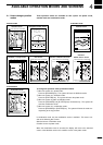
r PLOTTER MODEq AVAILABLE SCREENS AND INDICATIONS
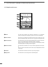
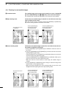
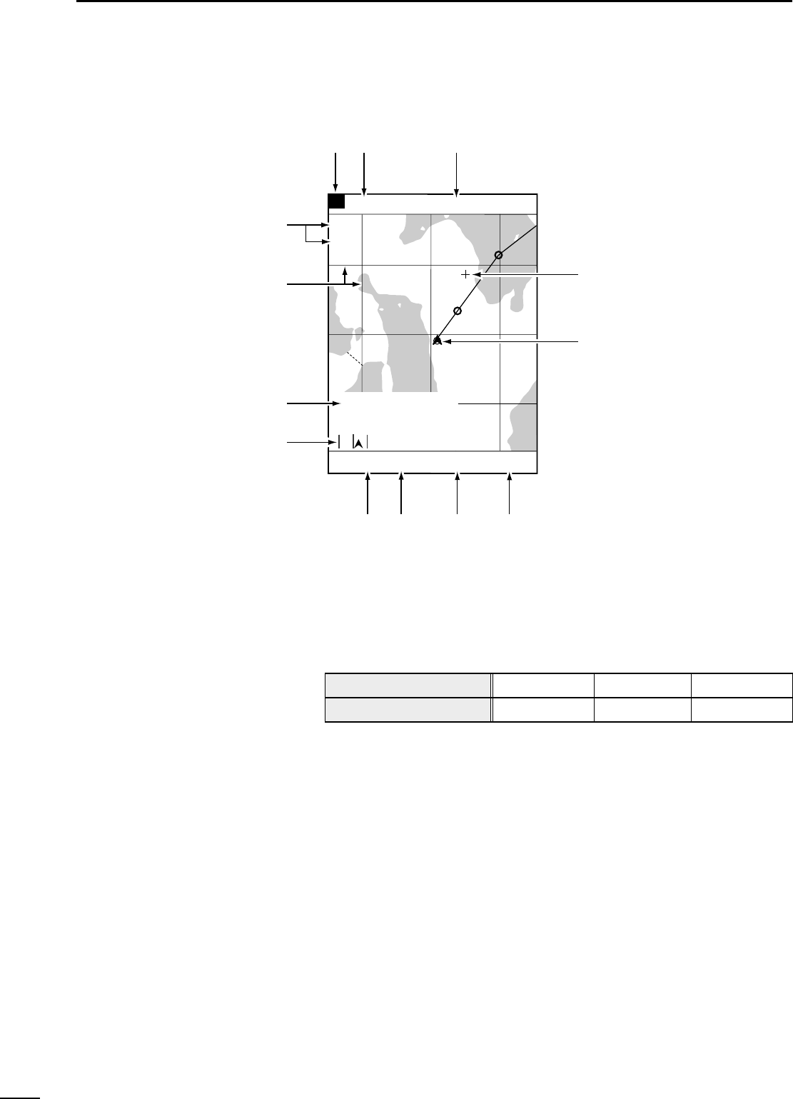
This field shows the current scale to which the coast line image is displayed. The
coastline image can be zoomed in or out to a total of 16 scales (☞ P. 17).
This field shows the positioning device in use.
This field shows the current ship position in latitude/longitude.
White characters in the field mean that the positioning is done normally.
Red characters in the field suggest that the system fails to pinpoint the current ship
position due to a positioning error or the like.
The field is blank if no data is received for 10 seconds or more due to a connection
error.
The cross hair cursor appears on the screen when the [UP]/[DOWN] or
[LEFT]/[RIGHT] key is pressed.
This mark shows the current ship position. The ship is currently located at the cen-
ter of this mark.
This mark changes to “\” when the ship slows down to 3 knots (or equivalent in
km/h or Ml/h) or less.
This field shows the current depth of water.
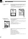
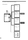
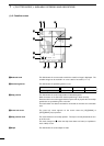
(1)-2 Coastline screen
8
0°T 12KT 54.3°F
ARRV
ALRM
FISH
ALRM
RANGE 32
TO WP 1
23.00
NM
30°
34°21.362N 28°
135°06.950E 18.05
NM
1:32
80.0 FT
n
m
,
.
⁄11
⁄22
⁄3
⁄0
v
b
z
x
c
z Reduced scale
x Positioning device
c Ship position
v Cross hair cursor
b Ship position mark
n Depth
Indication
Positioning device in use
DGPS
DGPS+GPS
GPS
GPS
EXT
External NMEA