- •- S_S!_
left.
Thesatellitenumber(SAT)inusebythechannelshowstotherightof
flMflUC
-
uwmauc
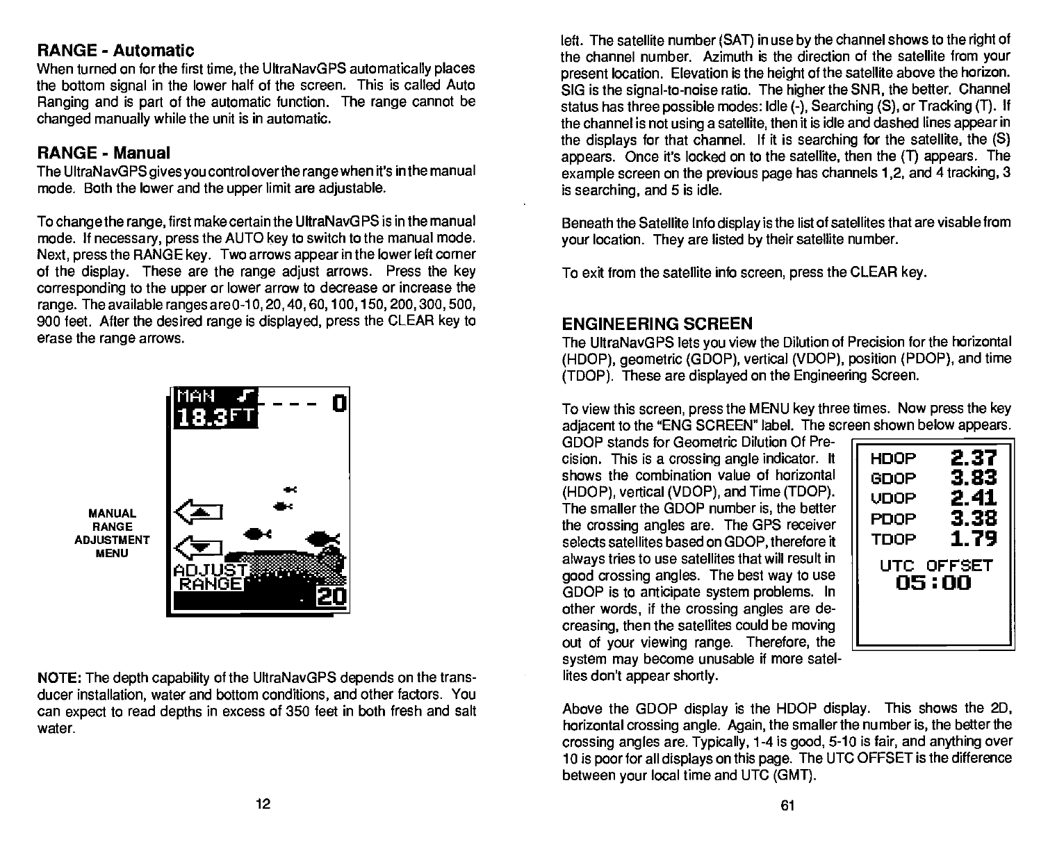
When turned on for the first
time,
the UItraNavGPS
automatically places
the bottom
signal
in the lower half of the screen. This is called Auto
Ranging
and is
part
of the automatic function. The
range
cannot
be
changed manually
while the unit is in automatic.
RANGE
-
Manual
The UltraNavGPS
gives you
control overthe
rangewhen
it's
in
the
manual
mode. Both the lower and the
upper
limit are
adjustable.
To
changethe range,
first make certain the UItraNavGPS is in the manual
mode. If
necessary, press
the AUTO
key
to switch to the manual mode.
Next,
press
the RANGE
key.
Two arrows
appear
in
the
lower left corner
of the
display.
These are the
range adjust
arrows. Press the
key
corresponding
to the
upper
or lower arrow to decrease or increase the
range.
The available
ranges
are 0-1
0,20,40,60,100,150,200,300,500,
900 feet. After the desired
range
is
displayed, press
the
CLEAR
key
to
erase the
range
arrows.
MANUAL
RANGE
ADJUSTMENT
MENU
NOTE: The
depth capability
of the UltraNavGPS
depends
on the trans-
ducer
installation,
water and bottom
conditions,
and other factors. You
can
expect
to read
depths
in excess of 350 feet in both fresh and salt
water.
the channel number.
Azimuth is the direction of the satellite from
your
present
location. Elevation
is the
height
of the satellite above the horizon.
SIG is the
signal-to-noise
ratio. The
higher
the
SNR,
the better. Channel
status has three
possible
modes: Idle
(-), Searching(S),
or
Tracking (1).
If
the channel is not
using
a
satellite,
then it is idle and dashed lines
appear
in
the
displays
for that channel. If it is
searching
for the
satellite,
the
(S)
appears.
Once it's locked on to the
satellite,
then the
(T) appears.
The
example
screen on the
previous page
has channels
1,2,
and
4
tracking,
3
is
searching,
and 5 is idle.
Beneath the Satellite Info
display
is the list of satellites that are
visable from
your
location.
They
are listed
by
their satellite number.
To exit from the satellite info
screen,
press
the CLEAR
key.
ENGINEERING SCREEN
The UltraNavGPS lets
you
view the Dilution of Precision for the
horizontal
(HDOP), geometric (GDOP),
vertical
(VDOP),
position (PDOP),
and time
(TDOP).
These are
displayed
on the
Engineering
Screen.
To view this
screen,
press
the MENU
key
three
times. Now
press
the
key
adjacent
to the "ENG SCREEN"
label. The screen shown below
appears.
GDOP stands for Geometric Dilution
Of Pre-
cision. This is a
crossing angle
indicator.
It
shows the
combination value of horizontal
(HDOP),
vertical
(VDOP),
and Time
(TDOP).
The smaller the GDOP number
is,
the better
the
crossing angles
are. The GPS receiver
selects satellites based
on
GDOP,
therefore it
always
tries to use satellites that will result in
good crossing angles.
The best
way
to use
GDOP is to
anticipate system problems.
In
other
words,
if the
crossing angles
are de-
creasing,
then the satellites
could be
moving
out
of
your viewing
range. Therefore,
the
______________________
system may
become unusable if more satel-
lites don't
appear shortly.
Above the GOOP
display
is the HDOP
display.
This shows the
2D,
horizontal
crossing angle. Again,
the smaller the number
is,
the better
the
crossing angles
are.
Typically,
1-4 is
good,
5-10 is
fair,
and
anything
over
10 is
poor
for all
displays
on this
page.
The UTC OFFSET is the difference
between
your
local time and UTC
(GMT).
12
61
MiTh1 t
j33FT
0
r
flDJUST
R'HOEi
HOOP
2.37
GOOP
3.83
'JooP
2.41
PooP
3.38
TOOP
1.79
UTC OFFSET
05:00
PDF compression, OCR, web-optimization with CVISION's PdfCompressor


