


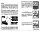
Saving
Present Position
-
View and Save Method
The "Quick Save" feature doesn't let
you
select the
waypoint
number. You
have to use the next available number when
using
that method. The View
and Save method lets
you pick
the
waypoint
number that
your present
position
is stored in.
(Note:
You can store a
position
under a
waypoint
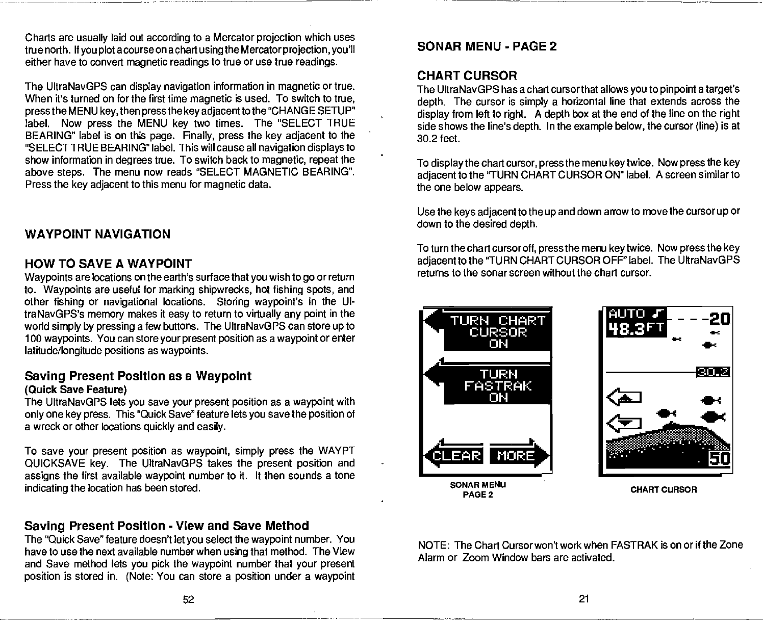
NOTE: The Chart Cursor won't work when FASTRAK is on or
if
the
Zone
Alarm or Zoom Window bars are activated.
52
21
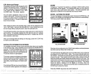
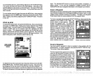
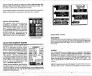
SONAR MENU
-
PAGE
2
CHART CURSOR
The UltraNavGPS has a chart cursorthat allows
you
to
pinpoint
a
target's
depth.
The cursor is
simply
a horizontal line that extends across the
display
from left to
right.
A
depth
box at the end of the line on the
right
side shows the line's
depth.
In the
example below,
the cursor
(line)
is at
30.2 feet.
To
display
the chart
cursor,
press
the menu
keytwice.
Now
press
the
key
adjacent
to the "TURN CHART CURSOR ON" label. A screen similar to
the one below
appears.
Use the
keys adjacent
to the
up
and down arrow to move the cursor
up
or
down to the desired
depth.
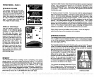
To turn the chart cursor
off,
press
the menu
key
twice.
Now
press
the
key
adjacentto
the 'TURN CHART CURSOR OFF" label. The UltraNavGPS
returns to the sonar screen without the chart cursor.
Charts
are
usually
laid out
according
to a Mercator
projection
which uses
true north.
ltyou plot
acourse
on a chart
usingthe Mercatorprojection, you'll
either have to convert
magnetic readings
to true
or use true
readings.
The UltraNavGPS can
display navigation
information in
magnetic
or true.
When it's turned on for the first time
magnetic
is used. To switch to
true,
press
the
MENU
key,
then
press
the
key adjacent
to the 'CHANGE SETUP"
label. Now
press
the MENU
key
two times.
The "SELECT TRUE
BEARING" label is on this
page. Finally, press
the
key adjacent
to the
"SELECT
TRUE BEARING" label. This will cause all
navigation displays
to
show information
in
degrees
true. To switch
back to
magnetic, repeat
the
above
steps.
The menu now reads "SELECT MAGNETIC BEARING".
Press the
key adjacent
to
this menu for
magnetic
data.
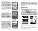
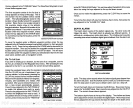
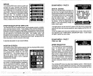
WAYPOINT NAVIGATION
HOW TO SAVE A WAYPOINT
Waypoints
are locations
on
the earth's surface
that
you
wish to
go
or return
to.
Waypoints
are useful for
marking shipwrecks,
hot
fishing spots,
and
other
fishing
or
navigational
locations.
Storing waypoint's
in the UI-
traNavGPS's
memory
makes it
easy
to return to
virtually any point
in the
world
simply by pressing
a few buttons. The UItraNavGPS can store
up
to
100
waypoints.
You can store
your present position
as a
waypoint
or enter
latitude/longitude positions
as
waypoints.
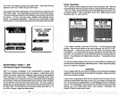
Saving
Present Position as a
Waypoint
(Quick
Save
Feature)
The UltraNavGPS lets
you
save
your
present
position
as a
waypoint
with
only
one
key press.
This "Quick Save"
feature lets
you
save the
position
of
a wreck or other locations
quickly
and
easily.
To save
your present position
as
waypoint, simply press
the WAYPT
QUICKSAVE
key.
The UltraNavGPS takes the
present position
and
assigns
the first available
waypoint
number to it. It then sounds a
tone
indicating
the location has been stored.
r
TURN CHART
FASTRAK
AIJTO
'18.3
FT
---20
4-c
.4
____
.
MORE4
..
e
0
SONAR MENU
PAGE 2
CHART CURSOR
PDF compression, OCR, web-optimization with CVISION's PdfCompressor