


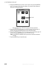

5. CUSTOMIZING YOUR UNIT
5-16
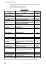
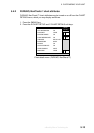
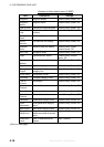
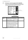
Contents of chart details menu (C-MAP)
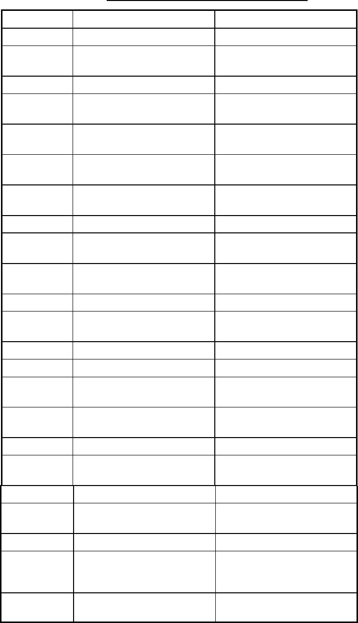
Item Description Settings
Waypoint Waypoint display Plotter/Overlay, Plotter, Off
Waypoint
Name
Waypoint name Plotter/Overlay, Plotter, Off
Lat/Lon Grid Latitude and longitude grids Plotter/Overlay, Plotter, Off
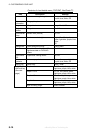
Chart Border
Line
Border lines
(indices)
Plotter/Overlay, Plotter, Off
Background
Color
Chart background color White, Black
Port &
Service
Port services icon display Plotter/Overlay, Plotter, Off
Attention
Area
Attention area icon display Plotter/Overlay, Plotter
Plotter/Contour, Off
Nav Lane Navigation lanes Plotter/Overlay, Plotter, Off
Light Lighthouse icon, sector Plotter/Overlay, Plot/No
Sector, Off
Buoy &
Beacon
Buoys, beacons display Plotter/Overlay, Plotter, Off
Signal Signals category icon Plotter/Overlay, Plotter, Off
Cartographic
Object
Cartographic objects
category icon
Plotter/Overlay, Plotter, Off
Place Name Geographic names Plotter/Overlay, Plotter, Off
Compass Compass category icons Plotter/Overlay, Plotter, Off
Tide &
Current
Tide display Plotter/Overlay, Plotter, Off
Natural
Feature
Land outline Plotter/Overlay, Plotter, Off
River & Lake Rivers and lakes Plotter/Overlay, Plotter, Off
Cultural
Feature
Cultural features icons Plotter/Overlay, Plotter, Off
Landmark Landmarks category icons Plotter/Overlay, Plotter, Off
Chart
Generation
Chart generation category
icons
Plotter/Overlay, Plotter, Off
New Object New object category icons Plotter/Overlay, Plotter, Off
Complex
Object Icon
Single or multiple icon for
object composed of several
icons
Multiple, Single
Information
Level
Basic or detailed data for
objects
Basic, Detailed
(Con’t on next page)
offered by Busse-Yachtshop.de