


Three options are available for units of measurement: Nautical miles and nautical miles per hour,
statute miles and statute miles per hour, and kilometers and kilometers per hour. Select the
option which best suits your needs, and press ENTER to store that setting and proceed to the
next menu.
GO TO: Creates a temporary route to a point selected by PICK or with the cursor. Represents the
number 6 when the numeric keypad symbol is displayed.
HEADING
Default setting: True
There are two options for heading readout: True or Magnetic. Selecting True will orient all course
information to true north, conforming with the lat-Ion coordinate system. If you choose Magnetic
north for a course reference, the NS 10 will calculate the magnetic variation at your present
position, and add to or subtract from the true course to present course readouts relative to
magnetic north. This is a matter of personal preference: True north corresponds to the lat-Ion
lines on marine charts, while a magnetic reading will match your magnetic compass readout.
HELP: Provides many help messages and provides further explanation of some functions. Help
information is not available from all screens.
KNOT: Nautical mile per hour. The normal measurement of speed for boats, expressed relative to
nautical miles instead of statute miles.
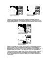
LAND MASS
Default setting: Black
Your NS 10 displays land mass as black, and bodies of water as white, however, if you choose,
you may reverse this by selecting white. Try it both ways and decide which option works best for
you.
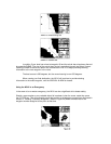
LAT/LON GRIDLINES
Default setting: off
You have the option of displaying nearby latitude and longitude lines in the graphics area of the
display. These are helpful in orienting your course of true north when the map is visible, and are
especially helpful when using the NS 10 with the map turned off, when out of the map coverage
area, or when the zoom range selected is too small to display a map. In these instances, the
Lat/Lon gridlines will be your only source of reference. The Lat/Lon gridlines are not displayed in
the forwardlooking mode.
LIGHT: Used to turn the backlight on and to adjust the brightness of the light.
MAGNETIC NORTH: The natural magnetic pole of the earth. This point is continually moving over
time, and differs from true north by several hundred miles. This is the point to which all magnetic
compasses will point.
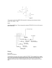
MAP: Pressing MAP once when using the Select System will return the map to the graphic area.
Pressing MAP when the map is already in the graphic area displays the Map Setup 1 menu,
pressing again displays the Map Setup 2 menu. (For additional information see "Additional User
Set-up Options" in section IV.)
MAP DATUM: A datum is an initial set of numeric geometrical quantities which are used as a
reference from which to measure other quantities used to define a region. From this information a
map is created. The NS 10 allows you to choose from a selected list of map datums or it will
default to the most commonly used map datum in your area.