


NAUTICAL MILE: Unit of distance with 1 nautical mile equating 1 minute of latitude or about 6000
feet.
NMEA INTERFACE (OUTPUT)
Default setting: off
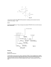
Connector #6 on the rear of the NS 10 is used to communicate with autopilots, plotters, radar etc.
The National Marine Electronics Association has developed a standard for communication
between electronic navigation instruments. Refer to section IX. Interface Options for more detail.
ORIGIN: This is the starting point of travel.
OFFSET: The numerical adjustments that are made to time, distance or direction to
accommodate a specific region.
PICK: Displays all information about any waypoint visible on the screen. Also represents the
number 9 when the numeric keypad symbol is displayed.
PLOTTER HISTORY
Default setting: 5 minutes
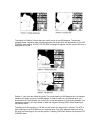
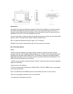
A course history line is shown in the graphics area, attached to the present position indicator.
This shows the history for your course, or where you have been. It is helpful in visualizing the
progress, or retracing your course to return to the starting point. A position point is displayed
every 30 seconds, but, you have the option to determine how much course history to display. This
represents minutes of course history and the options are: 5 minutes, 15 minutes, or 60 minutes,
all course history since you turned the NS 10 on, or no course history, which is the best selection
if you are stationary. Experimentation with these settings is the best way to find the option that
suits you.
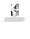
The NS 10 allots sufficient memory to store 240 position points, so when selecting ALL, be aware
that after recording two hours, the most distant points will begin to be replaced. The course
history line is not displayed when the PICK, CURSOR, ROUTE, or DIST (distance) mode is
turned on, but it is being recorded and will be displayed when the mode is turned off.
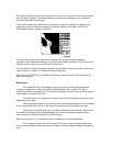
POSITION
Default setting: Lat/Lon
There are two options available for the display of your position: LAT LON is the default setting,
and provides your position with reference to the standard coordinate positioning of latitude and
longitude. The other option is unique to the NS 10. It allows position read-outs in reference to
Loran stations, the same way that Loran receivers work. The from of the readout is
in "time differentials" or simply "TD's". This feature is designed to appeal to long time loran users
who have stored points of interest by reference to TD's. While the NS 10 can be configured to
read-out in TD's, be aware that doing so requires a complete understanding of the loran system,
and the accuracy of position readouts is limited to the accuracy of both the loran system, and the
receiver used to store the points.
If you choose to display the position readout in TD's, the NS 10 will require much additional
information. If Loran TD's" is selected, the next several menus will ask you for the information
necessary to convert to TD's.
Select GRI; For TD readout only, the NS 10 must know the group repetition interval you wish to
use.