


Page 65CPV550
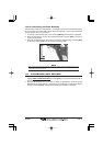
13.0 CHART PAGE
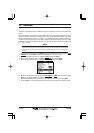
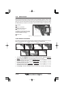
The Chart page is the main page of the GPS Chart Plotter. From this page the user can zoom
in/out, pan around the chart, show information about cartographic objects, see the exact
vessel position with the COG and SOG, place points, GOTO a destination point, show Track
history etc. The GPS Chart Plotter is provided with a Worldwide background showing C-MAP
NT
+
/MAX detail up to 2.0 NM. For more detail, optional C-MAP NT
+
/MAX C-CARDs are used.
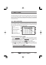
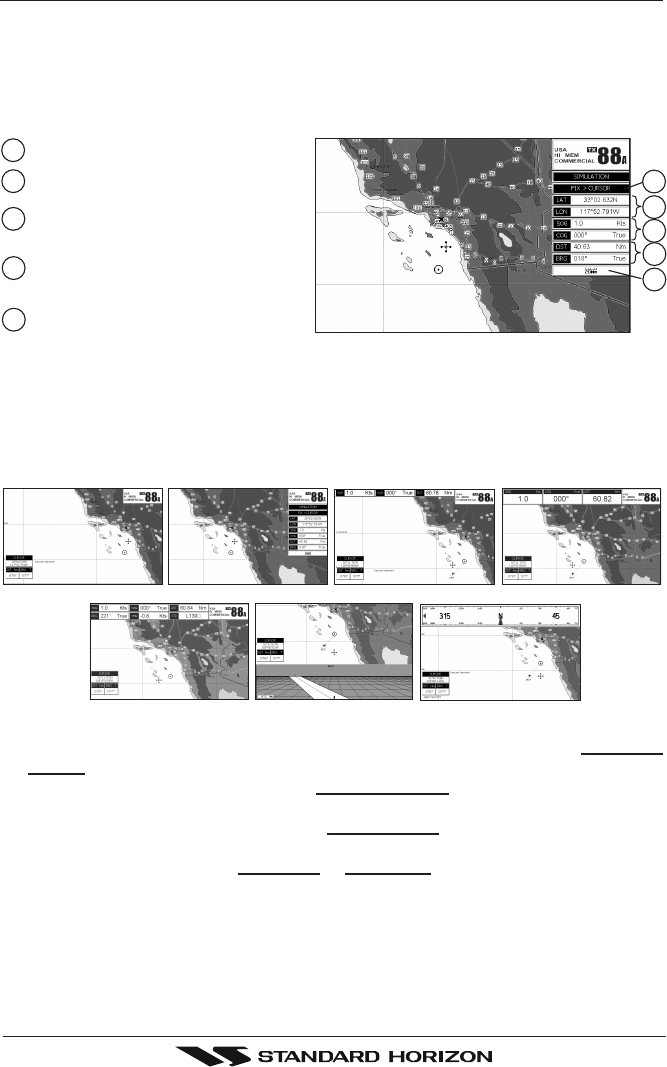
1
5
2
4
3
Speed Over Ground and
Course Over Ground
4
Cursor coordinates
2
Fix Status
1
Distance and Bearings from Fix to
Cursor (if the Fix is NOT received,
DST and BRG are empty)
3
Chart Scale
5
Figure 13.0 - Charts and general text area
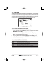
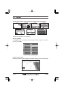
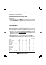
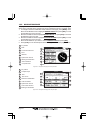
13.0.0 Window Selections
The window on the right side of the Chart page is called the General Window and it may be
edited, customized or even changed to show a highway or compass tape.
FULL CHART (None)
2 LINES SMALL
COMPASS
GENERAL
1 LINE SMALL
HIGHWAY
1 LINE LARGE
Figure 13.0.0 - Data window layout
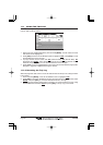
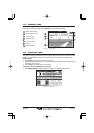
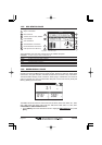
1. To change, press [MENU] twice. Move the ShuttlePoint knob to highlight GENERAL
SETUP and press [ENT] or move the ShuttlePoint knob to the right.
2. Move the ShuttlePoint knob to highlight
WINDOW SETUP and press [ENT] or move the
ShuttlePoint knob to the right.
3. Move the ShuttlePoint knob to highlight
CHART PAGE and press [ENT] or move the
ShuttlePoint knob to the right.
4. Select the desired window,
HIGHWAY or COMPASS, and press [ENT] or move the
ShuttlePoint knob to the right.
5. Press [CLR] or move the ShuttlePoint knob to exit the menu and show the Chart page.