


Page 72 CPV550
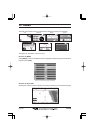
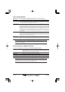
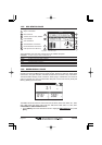
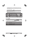
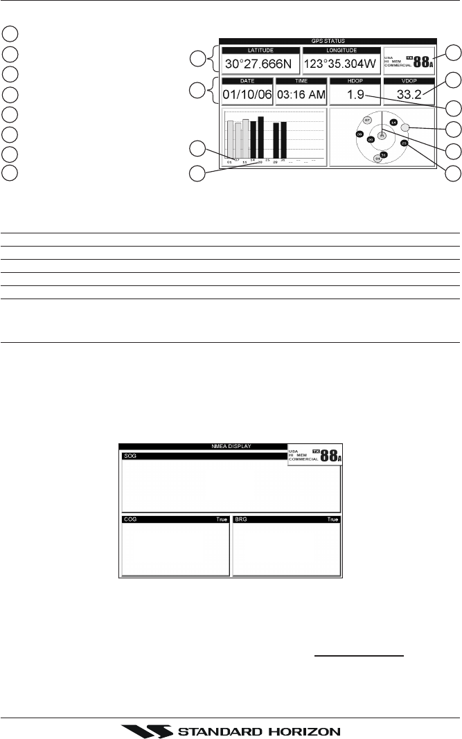
13.5 GPS STATUS PAGE
This page is used as a reference to see how well the GPS is receiving satellites.
Horizontal Dilution of Precision
4
2
Ship’s Coordinates
Tracked, but not used, Satellite
Used Satellite
COG (Course Over Ground)
1
7
8
6
3
Vertical Dilution of Precision
VHF information
Date and Time
5
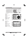
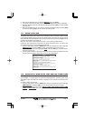
1
5
3
2
4
6
8
7
4
3
09
Figure 13.5 - GPS Status page
The WAAS/GPS Icon area may change due to the satellite reception:
ACQUIRING : the GPS is trying to receive a valid position fix.
GPS2D : The GPS is receiving at least 2 valid Satellites
GPS3D : the GPS is receiving at least 3 Satellites.
WAAS 2D/3D : the GPS is receiving a 2D or 3D position and the correction from the WAAS Satellite.
HDOP : Horizontal Dilution of Precision
VDOP : Vertical Dilution of Precision
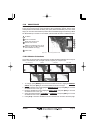
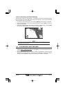
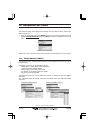
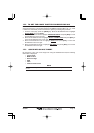
13.6 NMEA DISPLAY PAGE
The GPS Chart Plotter is capable of displaying information in the customizable data
windows from external NMEA devices. Depth sounder, Speed Log with temp, Wind speed
and direction, Flux gate compass, and GPS information can be shown in any of the boxes.
The default NMEA Display shows 3 windows. When going to a destination, this screen is
useful to navigate as to get to the destination keep the Course Over Ground (COG) and
Bearing (BRG) figures the same.
Kts
M
3.1
015°
353°
M
Figure 13.6 - NMEA Display page
The NMEA sentences read from external devices are: BWC, DSC, DSE, GGA, GLL, GSA,
GSV, HDG, HDM, HDT, RMC, VHW, VTG, DPT, DBT, MTW, VWR, VWT, TLL, WPL, RTE.
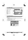
CHANGING the NMEA PAGE Windows
1. Press [MENU]. Move the ShuttlePoint knob to highlight
NMEA DISPLAY and press
[ENT].