


Page 67CPV550
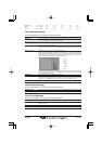
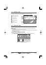
Obstructions Icon + Depth Icon Icon Icon Icon Icon
Diffusers Icon + Depth Icon Icon Icon Icon Icon
Wrecks Icon + Depth Icon Icon Icon Icon Icon
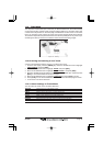
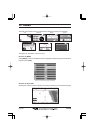
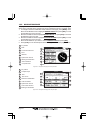
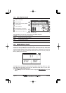
13.0.4 Marine Settings
To control the display on the map of the marine features.
Place Names : Turns the Local area names On or Off.
Names Tags : Turns On or Off a tag for particular chart objects that either includes the Name of the chart
object or the Depth of an Underwater chart object.
Nav Aids & Light Sectors: Turns the presentation of Lights, Signals, Buoys and Beacons On (Nav-Aids & Light
Sectors are shown), Off (Nav-Aids & Light Sectors are not shown) or Icon (Nav-Aids are
shown, Light Sectors are hidden).
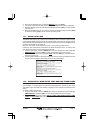
Attention Areas : Turns the displaying of Attention Areas (areas in which special attention by the mariner is
required because of natural or man-made hazards sailing regulations and restrictions) On
or Off.
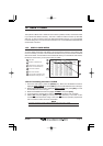
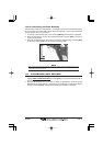
Tides & Currents : Turns the displaying of Tides and Currents On or Off.
When data/time is available, Tidal stream arrows are shown on the charts, indicating the
direction and strength of the Tide. If no data/time is available from the GPS or the GPS
Chart Plotter is not in Simulation mode, the icon on the map is generic one. The color of
the arrow denotes the strength of the current as follows:
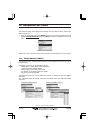
When the GPS Chart Plotter receives a valid position fix, the Tide icons are shown on
the charts on the basis of the current date and time: the screen displays and changes
arrows as date/time changes.
Seabed Type : Turns the displaying of the Seabed type On or Off.
Ports & Services : Turns the displaying of Ports and Service icons On of Off. Areas along the shore with
facilities for mooring, downloading and uploading of ships, generally sheltered from waves
and winds. Port installations are piers, wharves, pontoons, dry docks, cranes....
Tracks & Routes : Turns displaying of underwater objects On or Off. Objects are obstructions, wrecks, cable etc.
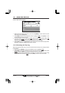
13.0.5 Depth Settings
To control the display on the map of the depth informations.
Depth Range Min : Sets the minimum depth limit to show Depth Sounding, Bathymetric Lines and Depth Area.
Depth Range Max : Sets the max depth limit to show Depth Sounding, Bathymetric Lines and Depth Area.
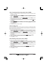
13.0.6 Land Settings
To control the display on the map of the terrestrial features.
Land Elevations : Turns the displaying of Land Elevations On or Off.
Land Elevation Values : The Land Elevation areas are always shown, but it is possible to turn the displaying of Land
Elevation On or Off.
Roads : Turns the displaying to roads On or Off.
Points of interest : Turns the displaying of Points of Information On or Off.