


Page 75CPV550
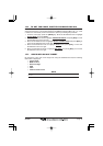
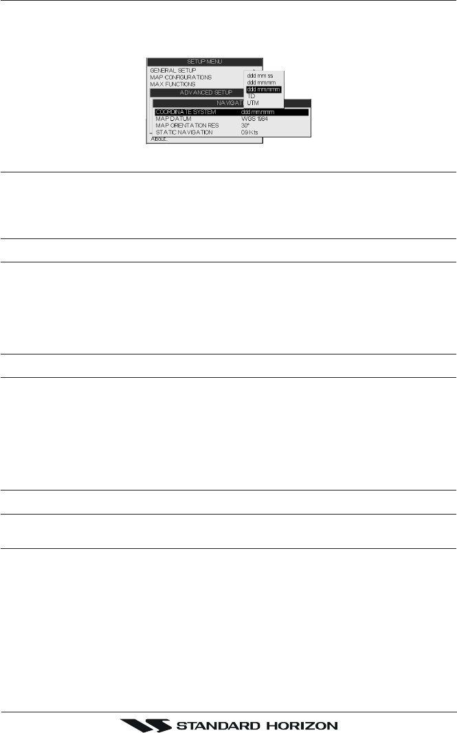
14.1 NAVIGATE
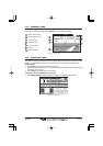
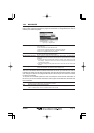
The Navigate Menu allows customization of the Coordinate System (Loran TD's), Map
Datum, Map Orientation Resolution (angle the vessel has to change before the chart is
redrawn) and Static Navigation.
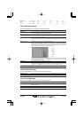
Figure 14.1 - Navigate Menu
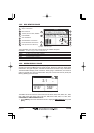
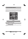
Coordinate System : Selections are:
a. TD: Loran TD
b. UTM: Universal Transverse Mercator Grid
c. ddd mm.mmm: Degrees Minutes and Thousands of Minutes
d. ddd mm.mm: Degrees Minutes and Hundredths of Minutes
e. ddd mm.ss: Degrees Minutes and Seconds
Map Datum : Allows selection of Map Datums. The default Datum is WGS84 as C-MAP cartography
has been compiled using the WGS84 Datum.
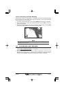
Map Orientation Resolution: Sets the angle the vessel has to change before the chart is redrawn. The default setting
is 30 degrees. Example: if the vessel is heading 000T at a speed of 25 Knots, the display
will redraw:
a. In Home mode the GPS Chart Plotter centers the location of the vessel in the center
of the display. To keep the vessel in the center of the display the GPS Chart Plotter
will occasionally redraw.
b. If the vessel changes course greater than 330T or more than 30T the chart will be
redrawn.
Static Navigation : Sets up a threshold for the speed. When the speed received from the positioning device
is under that threshold, the GPS Chart Plotter displays zero.
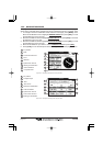
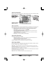
The Loran TD selection allows the GPS Chart Plotter to be set up so the user can enter in
LORAN TD’s directly into the GPS Chart Plotter. After the TD’s have been entered, and the
user changes to ddd mm.sss (Degrees Minutes and Seconds) the TD’s will be converted
to Lat/Lon coordinates.
To use the TD Coordinate System the user must setup the Chain and Pair information of
the TD’s. If you do not know this information, refer to paper charts that show the Chain and
Pair information.
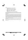
ASF1/2 : Additional Secondary phase Factor (TD Coordinate System)
Correction to TD1/2 values which can be inserted by the user.
Alter : Alternate Solution (TD Coordinate System)
Parameter selected by the user that is applied in the conversion of TD values to geographical coordinates
Lat/Lon. It defines which of the two possible solutions can be used.