


APPENDIX
AP-46
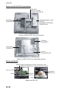
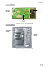
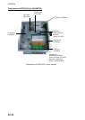
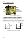
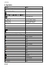
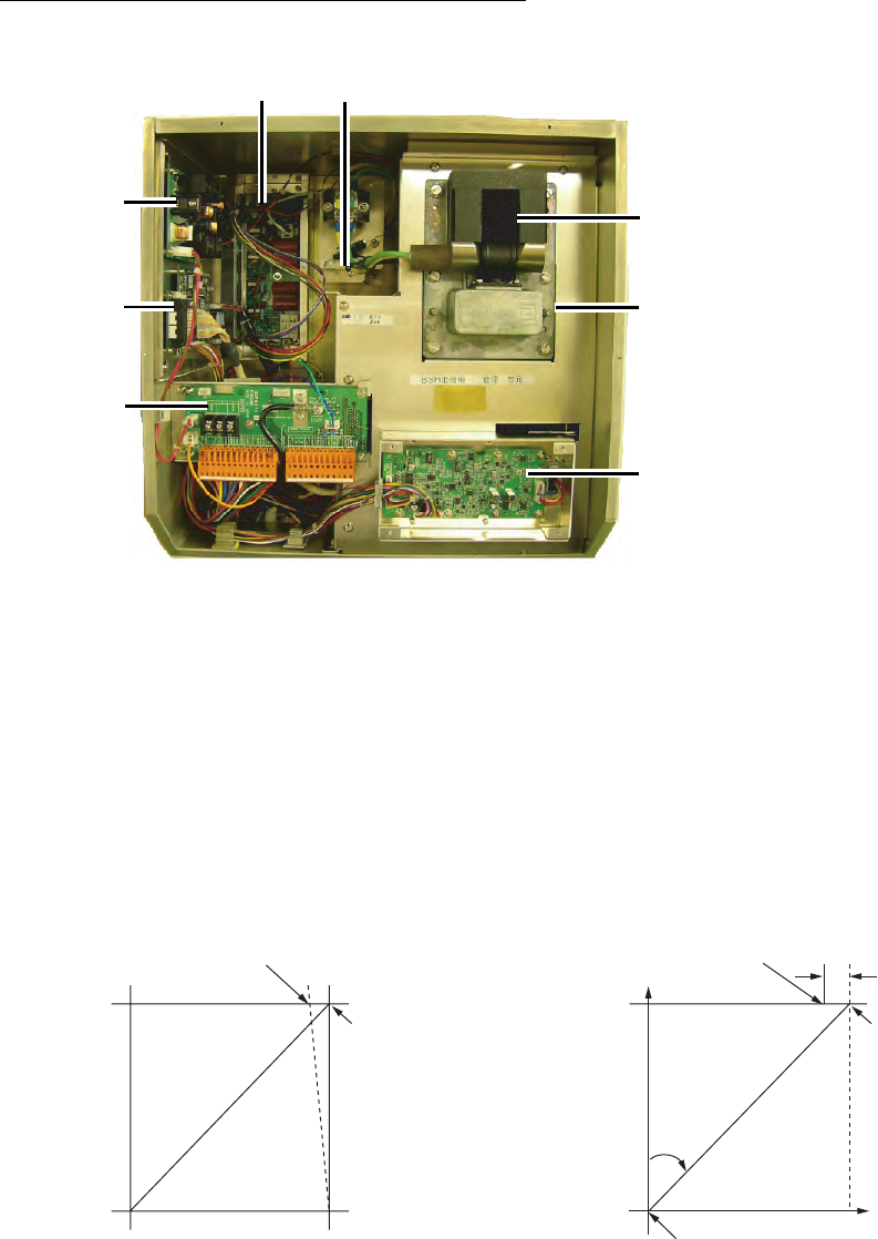
Transceiver unit RTR-082 (for FAR-2837SW)
IF Board (03P9335)
TB Board
(03P9349)
RFC Board
(03P9346)
RF PWR Board
(03P9348)
MD Board
(03P9244)
Magnetron
(MG5223F)
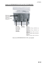
Beneath plate
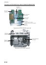
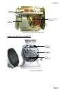
MIC Assy. (RU-9760A)
Circulator (RC4910S)
TR Limiter (TL378A)
Fan Motor (MSS-09B24DH-R)
Pulse Transformer
(RT-9273)
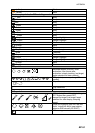
Transceiver unit RTR-082, cover opened
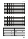
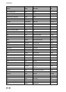
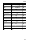
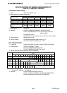
4. Longitude Error Table (on 96 nm range scale)
The longitude lines concentrate on the north pole and south pole, namely, 1 nm is
equivalent to 1 minute at 0 degree latitude, 2 minutes at 60 degrees latitude, 3 minutes at
70 degrees latitude and so on. For this reason, a longitude error occurs on the radar display.
For example, when own ship is at 60°N and 135°E, even if the cursor indication is 62°N and
139°E, the real cursor position is deviated to the left (west) side. The table below shows the
longitude error, represented from 0° to 90° at 96 nm from the radar center (own ship).
62°N °N
60°N
135°E
°E
96 nm
θ
Real cursor position
Cursor position
indicated
139°E
LAT
Real cursor position
R: Error
Cursor position
indicated
OS position
Distance error in direction of longitude due to latitude