


58
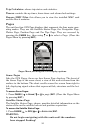
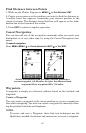
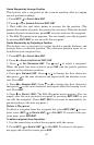
The plotter's zoom range is the distance across the screen. This number
shows in the lower right corner of the screen. In the first example fig-
ure below, the range is 4,000 miles from the left edge of the display to
the right edge.
The Zoom In and Zoom Out keys zoom the plotter to enlarge or reduce
its coverage area and the amount of detail shown. There are 39 avail-
able zoom ranges, from 0.02 miles to 4,000 miles.
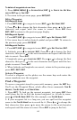
The Plotter Page has its own menu, which is used for several functions
and for setting various options. To access the Plotter Page Menu, from
the Plotter Page, press
MENU.
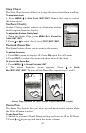
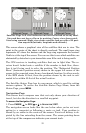
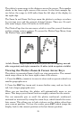
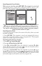
At left, Plotter Page zoomed to 30 miles (note the overlapping, unread-
able waypoints) and right, zoomed to 15 miles (with waypoints visible).
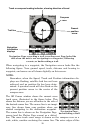
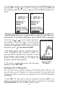
Viewing the Plotter: Zoom & Cursor Arrow Keys
The plotter is presented from a bird's eye view perspective. The current
zoom range shows in the lower right corner of the screen.
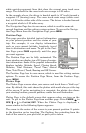
1. Press the
ZIN key (zoom in) to move in closer and see greater detail in a
smaller geographic area.
2. Press the
ZOUT key (zoom out) to move farther away and see less de-
tail, but a larger geographic area.
When you are traveling, the plotter will automatically move as you
move. This keeps your current location roughly centered on the screen.
You can manually pan or scroll the plotter northward, southward,
eastward or westward by using the arrow keys, which launch the cross-
hair cursor. This allows you to look at places on the plotter other than
your current position. To clear the cursor, press
EXIT, which jumps the
display back to the current position or the last known position.