


6
GPS
Receiver/antenna: .........Internal 12 parallel channel GPS/WAAS.
Position updates:...........Every second.
Position points:..............1,000 waypoints; 1,000 event marker icons.
Man Overboard:.............MOB feature precisely marks man overboard
location with special icon, then automatically
displays navigation data to that position.
Audible alarms:..............Arrival/off-course/destination passed/anchor.
Graphic symbols for
waypoints or event
marker icons:..................42.
Routes: .............................100; up to 100 waypoints per route.
Plot Trails:.......................10 savable; up to 9,999 points per trail.
Zoom range: ....................39 ranges; 0.02 to 4,000 miles.
NOTICE!
The storage and operation temperature range for your unit is from
-4 degrees to +167 degrees Fahrenheit (-20 degrees to +75 degrees
Celsius). Extended storage or operation in temperatures higher or
lower than specified will damage the liquid crystal display in your
unit. This type of damage is not covered by the warranty. For more
information, contact the factory's Customer Service Department;
phone numbers are listed on the last page.
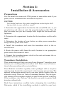
How to use this manual: typographical conventions
Most functions you perform with this unit are described as a sequence
of key strokes and selecting menu commands. Instructions for navigat-
ing a trail would look like this:
1. From the Plotter Page, press
MENU|MENU|↓ to MY TRAILS|ENT.
2. Press ↓ to Trail 1|
ENT|→|↓ to NAVIGATE|ENT.
Here is what the instructions mean:
Step 1: "From the Plotter Page. Press the Menu key twice. Use down ar-
row keys to select My Trails on the menu. Press the Enter key."
Step 2: "Use the down arrow key select the trail named Trail 1, and
press Enter. Press the right arrow key and then the down arrow key to
highlight the Navigate command. Press Enter."