


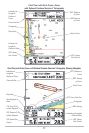
11
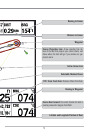
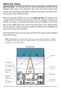
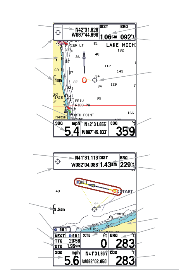
Chart View with Active Cursor, with Optional-Purchase Navionics® Cartography, Showing Navigation
COG: Course
Over Ground
Latitude and
Longitude
Position of Cursor
Cursor Info Box
Map Scale
Next Waypoint in
Route
TTG: Time To Go
to Next Waypoint
DTG: Distance To Go
to Next Waypoint
SOG: Speed Over
Ground
DIST: Distance to
Cursor
BRG: Bearing
to Cursor
Active Cursor
XTE: Cross Track Error
Cartography
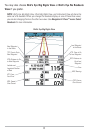
BRG: Bearing
Latitude and Longitude
Position of Boat
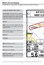
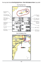
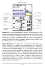
Chart View with Active Cursor, shown
with Optional-Purchase Navionics® Cartography
Latitude and
Longitude
Position of
Cursor
Cursor Info Box
Cartography
Map Scale
Latitude and
Longitude
Position of Boat
SOG: Speed
Over Ground
COG: Course
Over Ground
DIST: Distance
to Cursor
BRG: Bearing
to Cursor
Active Cursor