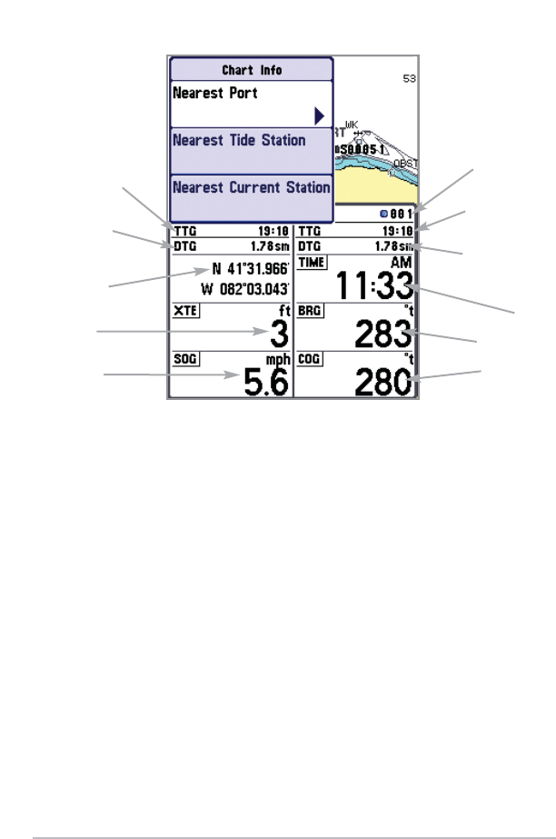
18
Nearest Port: The position and services information for the nearest port to your
present position will be displayed in an information box. Press the EXIT key to
remove the information box and the cursor bull’s eye will be centered over the
port position. The cursor information boxes at the bottom of the display will
indicate the distance and bearing to the port from your present position. Press
the EXIT key again to return to the Chart View.
Nearest Tide Station: Tide information for the nearest tide station to your
present position will be displayed in an information box. This includes the
position of the station and the times of the high and low tides for today’s date.
A tide graph is also displayed showing the rise and fall of the tides for the 24
hour time period encompassing the date. You can change the date to look at
tide information before or after the date displayed by pressing the LEFT or
RIGHT cursor key respectively. Press the EXIT key to remove the information box
and the cursor bull’s eye will be centered over the tide station position. The
cursor information boxes at the bottom of the display will indicate the distance
and bearing to the tide station from your present position. Press the EXIT key
again to return to the Chart View.
Chart Info Submenu
TTG: Time to Go
to Next Waypoint
DTG: Distance
to Go to Next
Waypoint
Latitude and
Longitude of Boat
XTE: Cross
Track Error
SOG: Speed
Over Ground
Last Waypoint
in Route
TTG: Time to Go
to Last Waypoint
DTG: Distance to
Go to Last
Waypoint
Time
BRG: Bearing
COG: Course
Over Ground