


GPSMAP
®
6000/7000 Series Owner’s Manual 99
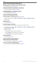
Sonar
Sonar
When connected to an optional Garmin GSD 22 sounder module and a transducer, your chartplotter
can be used as a shnder. The GSD 22 connects through the Garmin Marine Network and shares
sonar data with every chartplotter connected to the network.
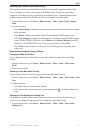
Sonar Views
The chartplotter shows sonar data using three different views: a full-screen view, a split-zoom view,
and a split-frequency view.
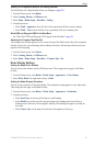
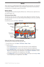
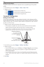
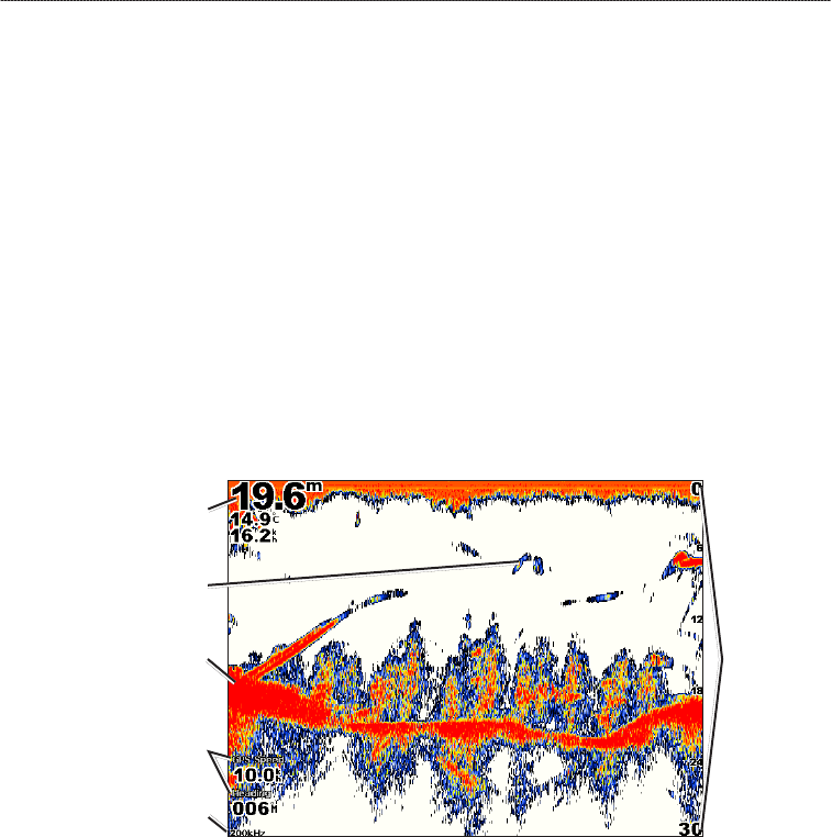
Full-screen Sonar View
The full-screen sonar view shows a full-view graph of sonar readings from a transducer. The range
scale along the right side of the screen shows the depth of detected objects as the screen scrolls from
the right to the left.
From the Home screen, select Sonar > Full Screen.
Full-screen Sonar View
Suspended
target
Bottom
Depth, temperature,
and water speed
GPS speed and
GPS heading
Transducer
frequency
Range
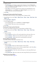
Setting the Zoom Level on the Full-screen View
You can zoom in to a section of the full-screen sonar view.
1. From the Home screen, select
Sonar > Full Screen > Menu > Zoom.
2. Complete an action:
Select 2x Zoom Auto Lock to zoom in on the sonar data at two-times magnication.
Select 4x Zoom Auto Lock to zoom in on the sonar data at four-times magnication.
Select Adjustable Zoom to set the depth range of the magnied area manually. Select Up or
Down to set the depth range of the magnied area. Select Zoom In or Zoom Out to increase
or decrease the magnication of the magnied area. Select Done.
Select Bottom Lock to zoom in on sonar data from the bottom depth, and select Up or Down
to set the depth range of the magnied area. Select Done.
•
•
•
•