


6 GPSMAP
®
6000/7000 Series Owner’s Manual
Charts and 3D Chart Views
Charts and 3D Chart Views
All GPSMAP 6000/7000 series chartplotters have a basic worldwide imagery map. The GPSMAP
6208, 6212, 7212, and 7215 chartplotters have built-in detailed BlueChart g2 offshore cartography
for US waters. The charts and 3D chart views listed below are available on the chartplotter.
NOTE: The Fishing chart, Mariner’s Eye 3D, and Fish Eye 3D are available with a preprogrammed
BlueChart g2 Vision data card (page 21).
Navigation Chart—shows navigation data available on your pre-loaded maps and from
supplemental maps, if available. The data includes buoys, lights, cables, depth soundings,
marinas, and tide stations in an overhead view (page 6).
Perspective 3D—shows a view from above and behind your boat for a visual navigation aid
(page 19).
Mariner’s Eye 3D—shows a detailed, three-dimensional view from above and behind the boat
for a visual navigation aid (page 22).
Fishing Chart—removes navigational data from the chart and enhances bottom contours for
depth recognition (page 24).
Fish Eye 3D—provides an underwater view that visually represents the sea oor according to the
chart’s information (page 24).
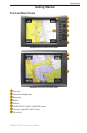
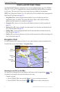
Navigation Chart
Use the Navigation chart to plan your course, to view map information, and as a navigational aid.
From the Home screen, select Charts > Navigation Chart.
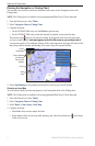
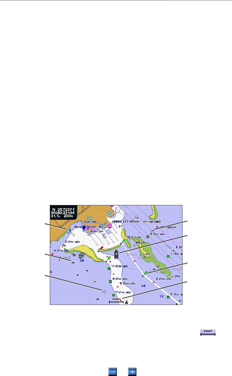
Navigation Chart with BlueChart g2 Vision Data
Buoy
Beacon
Your boat
Exposed
wreck
Marine
services
Zoom scale
Submerged
wreck
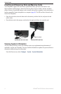
Zooming In and Out on the Map
The zoom level is indicated by the scale number at the bottom of the Navigation chart ( ). The
bar under the scale number represents that distance on the map.
Complete an action:
For the GPSMAP 6000 series, press the Range (-/+) keys to zoom out and zoom in.
For the GPSMAP 7000 series, touch the and buttons to zoom out and zoom in.
•
•
•
•
•
•
•