


10 GPSMAP
®
6000/7000 Series Owner’s Manual
Charts and 3D Chart Views
Viewing Tide Station Information
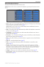
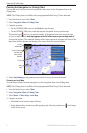
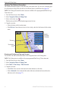
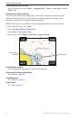
Tide-station information appears on the chart with a tide station icon. You can view a detailed graph
for a tide station to help predict the tide level at different times or on different days (page 46).
NOTE: The Fishing chart and tide station icons are available with a preprogrammed BlueChart g2
Vision data card.
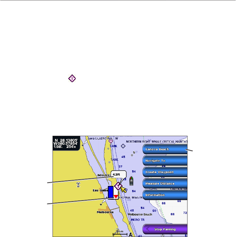
1. From the Home screen, select
Charts.
2. Select
Navigation Chart or Fishing Chart.
3. Select a tide station icon (
).
Tide direction and tide level information appear near the icon.
4. Complete an action:
Select the button with the station name.
Select Review if more than one item is in the vicinity, and select the button with the station
name.
Detailed
tide station
information
Tide level
Tide direction
arrow
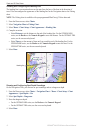
Showing and Conguring Tides and Currents
You can show tide and current information on the Navigation chart or the Fishing chart.
NOTE: The Fishing chart is available with a preprogrammed BlueChart g2 Vision data card.
1. From the Home screen, select
Charts.
2. Select
Navigation Chart or Fishing Chart.
3. Select
Menu > Chart Setup > Tides/Currents.
4. Complete an action:
Select On to show current station and tide station indicators on the chart.
Select Animated to show animated tide station indicators and animated current direction
indicators on the chart (page 27).
•
•
•
•