


GPSMAP
®
6000/7000 Series Owner’s Manual 17
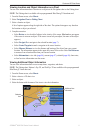
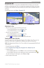
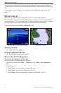
Charts and 3D Chart Views
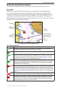
Showing AIS and MARPA Vessels on a Chart or on a 3D Chart View
AIS requires the use of an external AIS device and active transponder signals from other vessels.
Mini Automatic Radar Plotting Aid (MARPA) functionality works with radar (page 77).
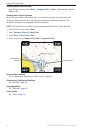
You can congure how other vessels appear on a chart or on a 3D chart view. The display range and
MARPA settings congured for one chart or one 3D chart view are applied only to that chart or to
that 3D chart view. The details, projected heading, and trails settings congured for one chart or one
3D chart view are applied to all charts and to all 3D chart views.
NOTE: The Fishing chart and Mariner’s Eye 3D are available with a preprogrammed BlueChart g2
Vision data card.
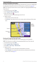
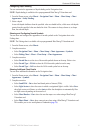
1. From the Home screen, select
Charts.
2. Select
Navigation Chart, Fishing Chart, Perspective 3D, or Mariner’s Eye 3D.
3. Select
Menu > Other Vessels > Display Setup.
4. Complete an action:
Select Display Range to indicate the distance from your location in which AIS vessels appear.
Select a distance.
Select MARPA > Show to show MARPA-tagged vessels.
Select Details > Show to show details about AIS-activated and MARPA-tagged vessels.
Select Proj. Heading to set the projected heading time for AIS-activated and MARPA-tagged
vessels. For the GPSMAP 6000 series, use the Rocker or the Numeric Keypad to enter the
time. For the GPSMAP 7000 series, use the on-screen keyboard. Select Done.
Select Trails to show the tracks of AIS vessels. Select the length of the track that appears
using a trail.
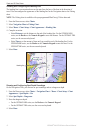
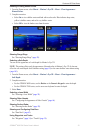
Activating a Target for an AIS Vessel
NOTE: The Fishing chart and Mariner’s Eye 3D are available with a preprogrammed BlueChart g2
Vision data card.
1. From the Home screen, select
Charts.
2. Select
Navigation Chart, Fishing Chart, Perspective 3D, or Mariner’s Eye 3D.
3. Complete an action:
For the GPSMAP 6000 series, use the Rocker to select an AIS vessel.
For the GPSMAP 7000 series, touch an AIS vessel.
4. Select
AIS Vessel > Activate Target.
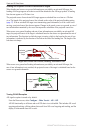
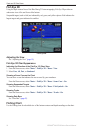
Viewing Information about a Targeted AIS Vessel
You can view the AIS signal status, MMSI, GPS speed, GPS heading, and other information that is
reported about a targeted AIS vessel.
1. From the Home screen, select
Charts.
2. Select
Navigation Chart, Fishing Chart, Perspective 3D, or Mariner’s Eye 3D.
3. Complete an action:
For the GPSMAP 6000 series, use the Rocker to select an AIS vessel.
For the GPSMAP 7000 series, touch an AIS vessel.
4. Select
AIS Vessel.
•
•
•
•
•
•
•
•
•