


GPSMAP
®
6000/7000 Series Owner’s Manual 5
Getting Started
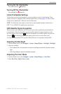
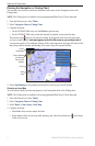
About the Home Screen
You can use the Home screen to access all other screens.
NOTE: Options on this screen vary based on the chartplotter type and optional connected network
devices.
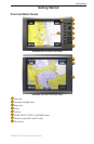
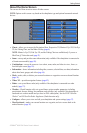
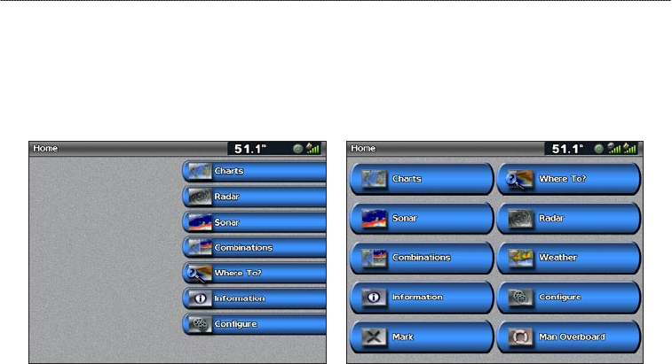
Home Screen GPSMAP 7000 Series
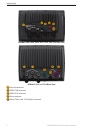
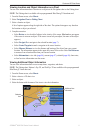
Home Screen GPSMAP 6000 Series
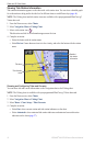
Charts—allows you to access the Navigation Chart, Perspective 3D, Mariner’s Eye 3D, Fish Eye
3D, the Fishing Chart, and the Radar Overlay (page 6).
NOTE: Mariner’s Eye 3D, Fish Eye 3D, and the Fishing Chart are available only if you use a
BlueChart g2 Vision data card (page 21).
Sonar—sets up and provides sonar information (only available if the chartplotter is connected to
a Garmin sonar module) (page 99).
Combinations—sets up the screen to view a chart, sonar, radar, and video in a two-, three-, or
four-eld split screen (page 28).
Information—shows information including tides, currents, celestial data, user data, information
about other boats, gauges, and video (page 46).
Mark—marks, edits, or deletes your current location as a waypoint or a man overboard location
(page 34).
Where To?
—provides navigation features (page 42).
Radar—sets up and shows radar (only available if the chartplotter is connected to a radar
module) (page 72).
Weather—(North America only) sets up and shows various weather parameters, including
precipitation, forecast, shing, sea conditions, and visibility (only available if the chartplotter is
connected to a weather module and you have an XM
®
subscription). See the XM WX Satellite
Weather
®
and XM Satellite Radio Supplement (North America only).
Congure—allows you to view and edit your chartplotter and system settings (page 57).
Man Overboard
—marks your current location as a waypoint, and sets a course back to the
marked location. (page 34).
•
•
•
•
•
•
•
•
•
•