


GPSMAP
®
6000/7000 Series Owner’s Manual 111
Digital Selective Calling
Editing Information in a Position Report
1. From the Home screen, select Information > DSC List.
2. Select a position-report call.
3. Select
Review > Edit.
4. Complete an action:
Select Name. For the GPSMAP 6000 series, use the Rocker to enter the name of the vessel.
For the GPSMAP 7000 series, use the on-screen keyboard. Select Done.
Select Symbol and select a new symbol. Select Done.
Select Comment. For the GPSMAP 6000 series, use the Rocker to enter the comment. For
the GPSMAP 7000 series, use the on-screen keyboard. Select Done.
Select Trail > Show to show a trail line for the vessel, if your radio is tracking the position of
the vessel.
Select Trail Line. Select a color for the trail line.
Deleting a Position-Report Call
1. From the Home screen, select Information > DSC List.
2. Select a position-report call.
3. Select
Review > Clear Report.
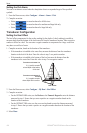
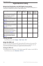
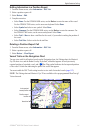
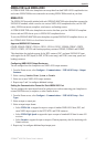
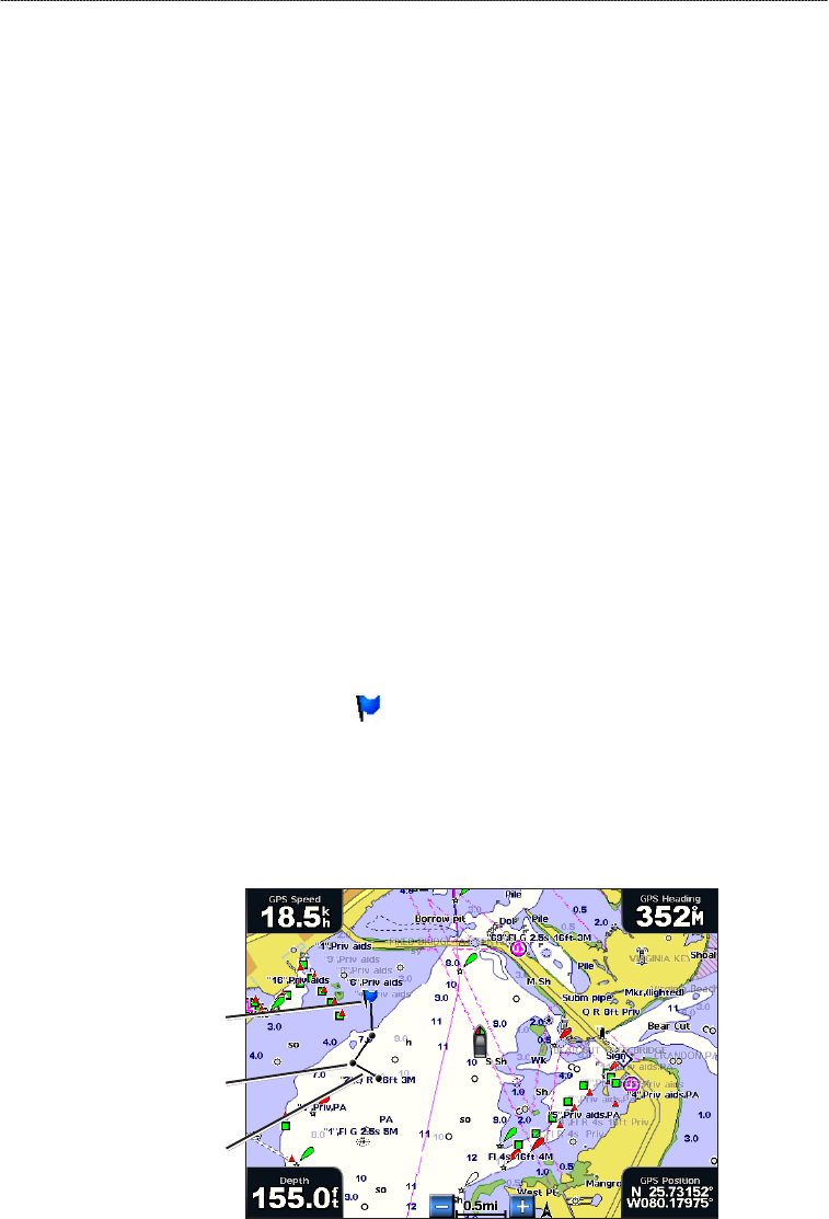
Vessel Trails on the Navigation Chart
You can view trails for all tracked vessels on the Navigation chart, the Fishing chart, the Mariner’s
Eye 3D chart view, and the Radar Overlay. By default, a black dot appears for each previously
reported position of a tracked vessel, and a Blue Flag symbol indicates the last reported position
of the vessel. A black line indicating the path of the vessel also appears.
You must enable the DSC Trails setting in order to view trails for tracked vessels (page 112).
NOTE: The Fishing chart and Mariner’s Eye 3D are available with a preprogrammed BlueChart g2
Vision data card.
Vessel trail
Last-reported
vessel position
Position-report
location
Vessel Trail on the Navigation Chart
•
•
•
•
•