


8 GPSMAP
®
6000/7000 Series Owner’s Manual
Charts and 3D Chart Views
Panning the Navigation or Fishing Chart
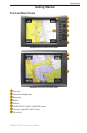
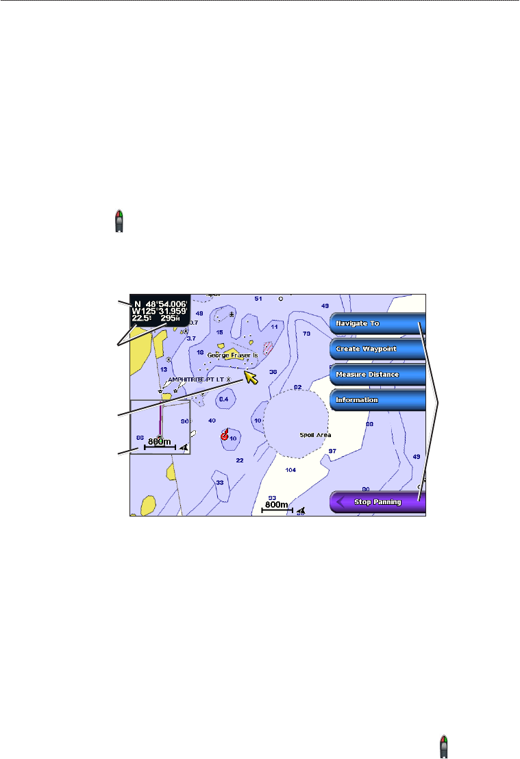
You can pan away from your current location and to other areas on the Navigation chart or the
Fishing chart.
NOTE: The Fishing chart is available with a preprogrammed BlueChart g2 Vision data card.
1. From the Home screen, select
Charts.
2. Select
Navigation Chart or Fishing Chart.
3. Complete an action:
For the GPSMAP 6000 series, use the Rocker to pan the map.
For the GPSMAP 7000 series, touch and drag the Navigation screen to pan the map.
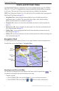
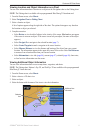
The position icon ( ) stays at your present location. If the position icon leaves the map when
you pan, a small window (inset map) appears on the left of the screen so you can keep track of
inset map) appears on the left of the screen so you can keep track of
your present position. The coordinate location of the cursor appears in the upper-left corner of the
map, along with the distance and bearing of the cursor from your present location.
Cursor
Inset
map
Pan
options
Cursor distance
and bearing
from current
location
Cursor
coordinates
4. Select Stop Panning to stop panning and return the screen to your current location.
Showing an Inset Map
You can control whether an inset map appears on the Navigation chart or the Fishing chart.
NOTE: The Fishing chart is available with a preprogrammed BlueChart g2 Vision data card.
1. From the Home screen, select
Charts.
2. Select
Navigation Chart or Fishing Chart.
3. Select
Menu > Chart Setup > Inset Map.
4. Complete an action:
Select On to show an inset map at all times.
Select Auto to show an inset map while panning, only when the position icon ( ) is no longer
visible on the screen.
•
•
•
•