


GPSMAP
®
6000/7000 Series Owner’s Manual 15
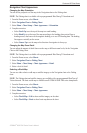
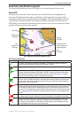
Charts and 3D Chart Views
Automatic Identication System
The Automatic Identication System (AIS) enables you to identify and track other vessels.
About AIS
AIS alerts you to area trafc. When connected to an external AIS device, the chartplotter can
show some AIS information about other vessels that are within range, that are equipped with a
transponder, and that are actively transmitting AIS information. The information reported for each
vessel includes the Maritime Mobile Service Identity (MMSI), the location, the GPS speed, the
GPS heading, the time that has elapsed since the last position of the vessel was reported, the nearest
approach, and the time to the nearest approach.
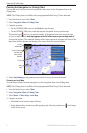
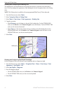
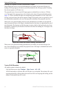
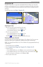
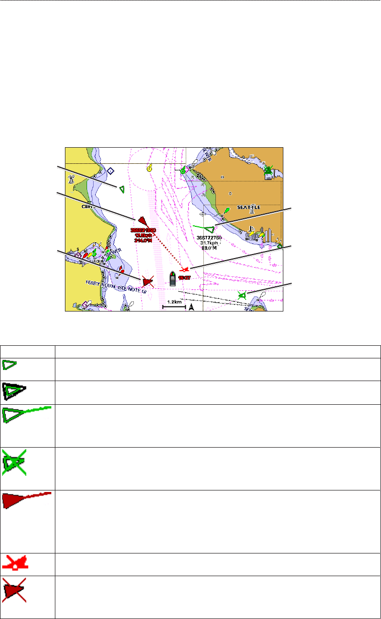
AIS Targeting on the Navigation Chart
Lost
AIS target
Lost
dangerous
AIS target
Tracking
AIS target
AIS target
Closest point and
time of approach to
dangerous target
Dangerous
AIS target
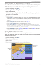
AIS Targeting Symbols
Symbol Description
AIS vessel. The vessel is reporting AIS information. The direction in which the triangle is
pointing indicates the direction in which the AIS vessel is moving.
Target has been selected.
Target has been activated. The target appears larger on the chart. A green line attached to
the target indicates the heading of the target. The MMSI, speed, and direction of the vessel
appear beneath the target, if the details setting has been set to Show (page 17). If the AIS
transmission from the vessel is lost, a message banner appears.
Target has been lost. A green X indicates that the AIS transmission from the vessel has
been lost, and the chartplotter displays a message banner asking whether the vessel should
continue to be tracked. If you discontinue vessel tracking, the lost target symbol disappears
from the chart or the 3D chart view.
Dangerous target in range. The target ashes while an alarm sounds and a message banner
appears. After the alarm has been acknowledged, a solid red triangle with a red line attached
to it indicates the location and the heading of the target. If the safe-zone collision alarm has
been set to Off, the target ashes, but the audible alarm does not sound and the alarm banner
does not appear (page 18). If the AIS transmission from the vessel is lost, a message banner
appears.
The location of this symbol indicates the closest point of approach to a dangerous target, and
the numbers near the symbol indicate the time to the closest point of approach to that target.
Dangerous target has been lost. A red X indicates that the AIS transmission from the vessel
has been lost, and the chartplotter displays a message banner asking whether the vessel
should continue to be tracked. If you discontinue vessel tracking, the lost dangerous target
symbol disappears from the chart or the 3D chart view.