


1. SYSTEM INTRODUCTION
1-21
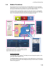
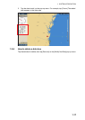
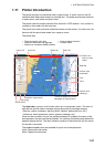
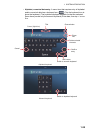
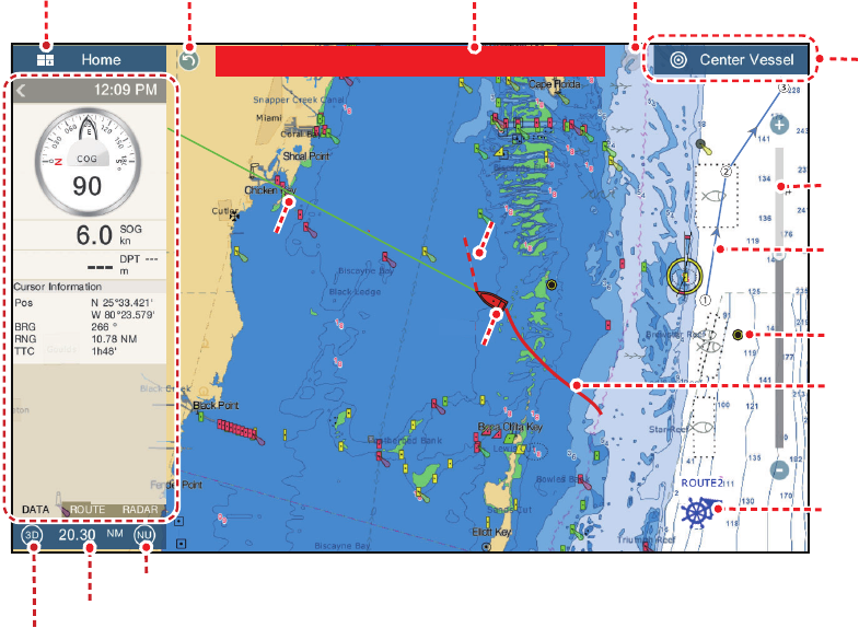
1.11 Plotter Introduction
The plotter provides a small world map in raster format. A vector chart for the US
coastline (with Alaska and Hawaii) is provided also. The plotter section has functions
to enter points, and create and plan routes.
The plotter receives position data fed from the built in GPS receiver. Your position is
marked on the screen with the boat icon.
The points and routes you have entered are shown on the screen. You can move, de-
lete and edit the points and routes from a pop-up menu.
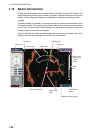
The plotter also
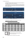
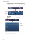
The status bar, common to all modes, alerts you to equipment status. The color of
both the bar and the status message change according to message category.
• Red bar, yellow characters: warning (alarm violation, equipment error, etc.)
• Yellow bar, black characters: caution (system message, etc.)
When an alert condition occurs, the equipment beeps (if enabled), the name of the
alert appears in the bar, and the bar flashes. You can stop the flashing and silence the
beep by tapping the bar. The alert indication remains in the status bar until the cause
for the alert is removed.
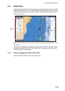
The undo and redo icons are available for point and route operations.
Undo: Reverse the last action.
Redo: Repeat the last action.
• Plots the track of your ship
• Measures distances and bearings
• Marks man overboard (MOB) position
• Controls alarm functions
• Follows routes
Undo icon Redo icon
Slider bar
Orientation mode switch
2D/3D switch
Chart range
Inactive route
(expanded)
Point
Track
COG
COG
Return own
ship to screen
center
Boat icon
Boat icon
Data
area
Data
area
Home icon
Inactive route
(sleeping)*
Heading
line
Heading
line
Depth Alarm
Status bar
* Arrival or departure position,
selectable on [Layers] menu.