


4. POINTS, EVENT MARKS
4-11
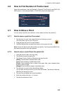
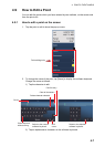
4.12.1 How to go to an on-screen point
1. Tap the desired point to show the pop-up menu.
2. Tap [Goto].
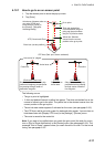
The following occurs:
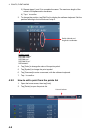
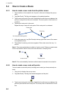
• The go to point is highlighted.
• A thick red dashed line and a yellow line appear. The thick red dashed line is the
course to follow to get to the point. The yellow line is the shortest course from the
current position to the go to point.
• The arrival area marker appears if activated on the menu (see paragraph 5.9.5).
• The XTE lines, red for port side, green for starboard side, appear. You can show or
hide these lines with [Display XTE Lines] in the [Settings] - [Routes] menu.
• The route is saved to the routes list.
Note: If you want to be notified when you reach the go to point (the end of a route),
turn on [End of Route Notification] in the [Routes] menu (see paragraph 5.9.9). The
message "End of Route" appears when you reach the end of a route. For the arrival
timing, see paragraph 5.9.5.
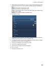
Go to point
XTE (Cross-track Error)
Boat icon (current position)
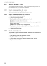
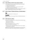
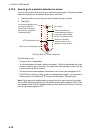
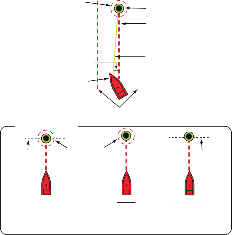
How arrival is “judged”
Arrival area
[Circle and Cross Line]
Cross line
Ship arrives to arrival area or ship
passes an imaginary perpendicular
line passing through center of
destination waypoint.
[Circle]
Ship arrives to
arrival area.
Cross line
[Cross Line]
Ship passes an imaginary
perpendicular line passing
through center of destina-
tion waypoint.
Yellow line: Shortest
course from the current
position to the go to point.
Thick red dashed line:
Course between the go to
point and the point where
the [Go To] function starts.
Arrival area (Appears when
you select [Circle and
Cross Line] or [Circle] in
the [Routes] - [Waypoint
Switching Mode].)
XTE lines (Red: port, Green: starboard)
0
0