


CPF180i and CPF300i Page 41
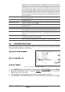
4. FIND SERVICES
4.0 USING FIND SERVICES & MORE FUNCTIONS
The CPF180i and CPF300i have a dedicated key that allows searching the optional C-MAP
B
Y JEPPESEN NT
+
/MAX C-CARD for Port Services, Ports, Tide Stations, Wrecks, Obstruc-
tions, Points Of Interest, Lakes, User Points or GPS Coordinates.
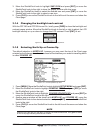
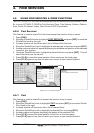
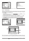
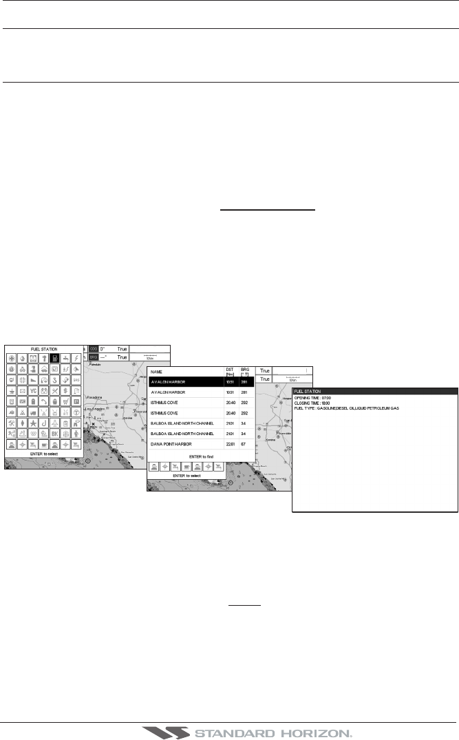
4.0.0 Port Services
This feature is used to locate Port Services nearest the position of your vessel.
1. Press [FIND].
2. Move the ShuttlePoint knob to highlight
PORT SERVICES and press [ENT] or move the
ShuttlePoint knob to the right.
3. A popup window will be shown with a list of different Port Services.
4. Move the ShuttlePoint knob to highlight the desired type of service and press [ENT].
5. Another popup window will appear displaying the distance and position of the services
closest to your location.
6. Using the ShuttlePoint knob, highlight the desired Service and press [ENT]. This will
show information on the service.
7. Press [CLR] to show the actual position of the service on the chart page.
8. Press [CLR] again at any time to return your cursor to your vessels position.
WAAS 3D
WAAS 3D
Figure 4.0.0 - Find Port Services
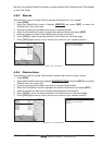
4.0.1 Port
This feature is used to locate Port nearest the position of your vessel.
1. Press [FIND].
2. Move the ShuttlePoint knob to highlight
PORT and press [ENT] or move the Shuttle-
Point knob to the right.
3. A popup window will be shown with a list of nearest Ports.
4. Move the ShuttlePoint knob to highlight the desired Port and press [ENT].
5. Another window will appear displaying the details of the selected Port.
6. Press [CLR] to show the actual position of the Port on the chart page.
7. Press [CLR] again at any time to return your cursor to your vessels position.